Barki Saria geodata
Barki Saria (Jharkhand) is a populated place; located in India in Asia/Kolkata (GMT+5.5) time zone. With population of 24,134 people, there are 1761 cities with bigger population in this country. Compared to other cities in India, 58.9% of cities are located further ↓South; 86.6% of cities are located further ←West and 70.8% of cities have lower elevation than Barki Saria. Note1


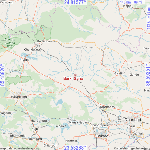
Barki Saria GPS coordinates[2]
24° 10' 33.384" North, 85° 53' 21.768" East
| Map corner | latitude | longitude |
|---|---|---|
| Upper-left | 24.81577°, | 85.18626° |
| Center: | 24.17594°, | 85.88938° |
| Lower-right: | 23.53288°, | 86.59251° |
| Map W x H: | 142.6×142.6 km | = 88.6×88.6mi |
| max Lat: | 34.9274° ⇑41.1% North |
| Barki Saria: | 24.17594° |
| min Lat: | ⇓58.9% South 8.09008° |
| min Long | Barki Saria | max Long |
| 68.82655° | 85.88938° | 96.81° |
| W 86.6%⇐ | ⇒13.4% E |
Elevation
Elevation of Barki Saria is 335 m = 1099 ft, and this is 39.4 m = 129 ft above average elevation for this country.
| Max E: |
3681 m = 12077 ft | 29.2% |
| Barki Saria | 335 m 1099 ft | |
| Avg. | 295.6 m = 970 ft | |
Min E: |
1 m = 3 ft | 70.8% |
See also: India elevation on elevation.city.
Geographical zone
Barki Saria is located in North temperate zone (between Tropic of Cancer and the Arctic Circle). Distance of this Northern Tropic circle is 82.2 km =51.1 mi to South.| Distance of | km | miles | from Barki Saria |
|---|---|---|---|
| North Pole | 7318.9 | 4547.8 | to North |
| Arctic Circle | 4713.1 | 2928.6 | to North |
| Tropic Cancer | 82.2 | 51.1 | to South |
| Equator | 2688.1 | 1670.3 | to South |


Nearby cities:
15 places around Barki Saria: (largest is in red/bold)
• Bokāro
43.8 km =27.2 mi,  171°
171°
• Dhanwār
27.7 km =17.2 mi,  19°
19°
• Dugda
55.8 km =34.7 mi,  149°
149°
• Gomoh
42.9 km =26.7 mi,  141°
141°
• Gumia
42.6 km =26.5 mi,  188°
188°
• Gīrīdīh
42.6 km =26.5 mi,  88°
88°
• Hazāribāgh
57.3 km =35.6 mi,  249°
249°
• Hesla
12.6 km =7.8 mi,  184°
184°
• Jumri Tilaiyā
46.5 km =28.9 mi,  308°
308°
• Kodarmā
44.1 km =27.4 mi,  317°
317°
• Kātrās
59.1 km =36.7 mi, 135°
• Malkera
59.6 km =37 mi, 137°
• Sāruberā
41.2 km =25.6 mi,  164°
164°
• Topchānchi
43.6 km =27.1 mi,  134°
134°
• patamda
49.9 km =31 mi,  286°
286°
Sources, notices
• [Note1] Compared only with cities in India existing in our database
• [Src1] Map data: © OpenStreetMap contributors (CC-BY-SA)
• [Src2] Other city data from geonames.org with taken over terms of usage.
• [Src3] Geographical zone / Annual Mean Temperature by Robert A. Rohde @ Wikipedia
