Goshaingaon geodata
Goshaingaon (Assam) is a populated place; located in India in Asia/Kolkata (GMT+5.5) time zone. With population of 13,933 people, there are 2570 cities with bigger population in this country. Compared to other cities in India, 74% of cities are located further ↓South; 95.6% of cities are located further ←West and 79.2% of cities have higher elevation than Goshaingaon. Note1


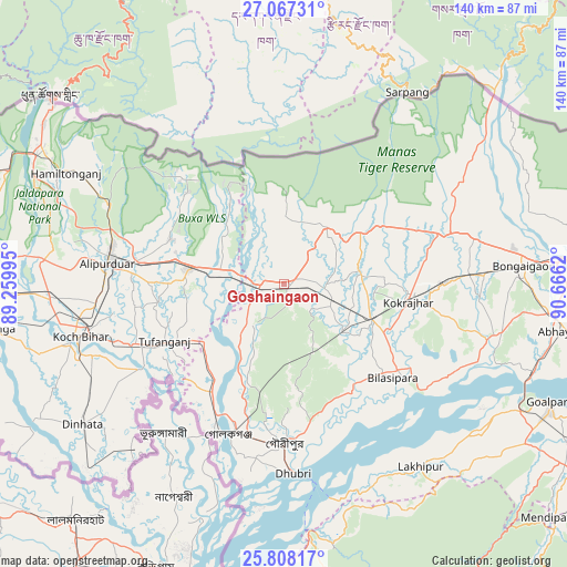
Goshaingaon GPS coordinates[2]
26° 26' 22.056" North, 89° 57' 47.052" East
| Map corner | latitude | longitude |
|---|---|---|
| Upper-left | 27.06731°, | 89.25995° |
| Center: | 26.43946°, | 89.96307° |
| Lower-right: | 25.80817°, | 90.6662° |
| Map W x H: | 140×140 km | = 87×87mi |
| max Lat: | 34.9274° ⇑26% North |
| Goshaingaon: | 26.43946° |
| min Lat: | ⇓74% South 8.09008° |
| min Long | Goshaingaon | max Long |
| 68.82655° | 89.96307° | 96.81° |
| W 95.6%⇐ | ⇒4.4% E |
Elevation
Elevation of Goshaingaon is 51 m = 167 ft, and this is 244.6 m = 802 ft below average elevation for this country.
| Max E: |
3681 m = 12077 ft | 79.2% |
| Avg. | 295.6 m = 970 ft | |
| Goshaingaon | 51 m = 167 ft | |
Min E: |
1 m = 3 ft | 20.8% |
See also: India elevation on elevation.city.
Geographical zone
Goshaingaon is located in North temperate zone (between Tropic of Cancer and the Arctic Circle). Distance of this Northern Tropic circle is 333.9 km =207.5 mi to South.| Distance of | km | miles | from Goshaingaon |
|---|---|---|---|
| North Pole | 7067.3 | 4391.4 | to North |
| Arctic Circle | 4461.4 | 2772.2 | to North |
| Tropic Cancer | 333.9 | 207.5 | to South |
| Equator | 2939.8 | 1826.7 | to South |


Nearby cities:
15 places around Goshaingaon: (largest is in red/bold)
• Alīpur Duār
44.1 km =27.4 mi,  276°
276°
• Bilāsipāra
35.5 km =22.1 mi,  130°
130°
• Bongaigaon
59.4 km =36.9 mi,  85°
85°
• Bāsugaon
45.5 km =28.3 mi, 86°
• Chāpar
51.5 km =32 mi,  111°
111°
• Dhuburi
46.9 km =29.1 mi,  177°
177°
• Dīnhāta
60.4 km =37.5 mi,  235°
235°
• Gauripur
39.6 km =24.6 mi, 180°
• Golakganj
40 km =24.9 mi,  200°
200°
• Koch Bihār
53.1 km =33 mi,  256°
256°
• Kokrajhar
31.1 km =19.3 mi,  97°
97°
• Lakhipur
56.9 km =35.4 mi,  143°
143°
• Latabāri
18.3 km =11.4 mi,  215°
215°
• Sapatgrām
19.6 km =12.2 mi, 125°
• Tufānganj
32.6 km =20.3 mi,  245°
245°
Sources, notices
• [Note1] Compared only with cities in India existing in our database
• [Src1] Map data: © OpenStreetMap contributors (CC-BY-SA)
• [Src2] Other city data from geonames.org with taken over terms of usage.
• [Src3] Geographical zone / Annual Mean Temperature by Robert A. Rohde @ Wikipedia
