Baranagar geodata
Baranagar (West Bengal) is a section of populated place; located in India in Asia/Kolkata (GMT+5.5) time zone. With population of 260,072 people, there are 163 cities with bigger population in this country. Compared to other cities in India, 51.7% of cities are located further ↑North; 93.5% of cities are located further ←West and 96.4% of cities have higher elevation than Baranagar. Note1


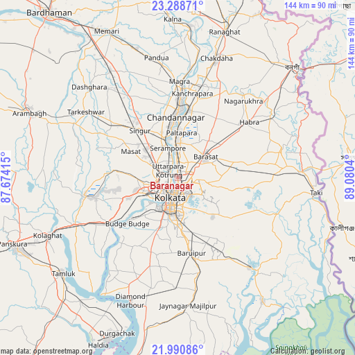
Baranagar GPS coordinates[2]
22° 38' 28.752" North, 88° 22' 38.172" East
| Map corner | latitude | longitude |
|---|---|---|
| Upper-left | 23.28871°, | 87.67415° |
| Center: | 22.64132°, | 88.37727° |
| Lower-right: | 21.99086°, | 89.0804° |
| Map W x H: | 144.3×144.3 km | = 89.7×89.7mi |
| max Lat: | 34.9274° ⇑51.7% North |
| Baranagar: | 22.64132° |
| min Lat: | ⇓48.3% South 8.09008° |
| min Long | Baranagar | max Long |
| 68.82655° | 88.37727° | 96.81° |
| W 93.5%⇐ | ⇒6.5% E |
Elevation
Elevation of Baranagar is 10 m = 33 ft, and this is 285.6 m = 937 ft below average elevation for this country.
| Max E: |
3681 m = 12077 ft | 96.4% |
| Avg. | 295.6 m = 970 ft | |
| Baranagar | 10 m = 33 ft | |
Min E: |
1 m = 3 ft | 3.6% |
See also: Baranagar elevation on elevation.city.
Geographical zone
Baranagar is located in North Torrid zone (between Equator and Tropic of Cancer). Distance of this Northern Tropic circle is 88.4 km =54.9 mi to North.| Distance of | km | miles | from Baranagar |
|---|---|---|---|
| North Pole | 7489.6 | 4653.8 | to North |
| Arctic Circle | 4883.7 | 3034.6 | to North |
| Tropic Cancer | 88.4 | 54.9 | to North |
| Equator | 2517.5 | 1564.3 | to South |


Nearby cities:
15 places around Baranagar: (largest is in red/bold)
• Bankra
11.1 km =6.9 mi,  247°
247°
• Bara Bazar
8.8 km =5.5 mi,  198°
198°
• Bāli
3.8 km =2.4 mi,  282°
282°
• Chakapara
3.1 km =1.9 mi, 251°
• Dam Dam
4.8 km =3 mi,  100°
100°
• Garui
2.5 km =1.6 mi,  110°
110°
• Hāora
9.4 km =5.8 mi,  220°
220°
• Khardah
8.6 km =5.3 mi,  0°
0°
• Kolkata
8.9 km =5.5 mi,  189°
189°
• Konnagar
7.8 km =4.8 mi,  334°
334°
• Kāmārhāti
3.3 km =2.1 mi,  355°
355°
• Madhyamgram
8.8 km =5.5 mi,  52°
52°
• Pānihāti
5.5 km =3.4 mi, 356°
• Rishra
9.7 km =6 mi,  340°
340°
• Sodpur
7.2 km =4.5 mi,  11°
11°
Sources, notices
• [Note1] Compared only with cities in India existing in our database
• [Src1] Map data: © OpenStreetMap contributors (CC-BY-SA)
• [Src2] Other city data from geonames.org with taken over terms of usage.
• [Src3] Geographical zone / Annual Mean Temperature by Robert A. Rohde @ Wikipedia
