Ajra geodata
Ajra (Maharashtra) is a populated place; located in India in Asia/Kolkata (GMT+5.5) time zone. With population of 15,864 people, there are 2380 cities with bigger population in this country. Compared to other cities in India, 77.7% of cities are located further ↑North; 88.3% of cities are located further →East and 91.2% of cities have lower elevation than Ajra. Note1


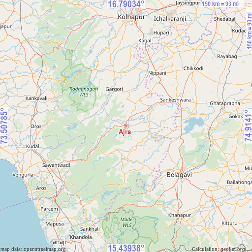
Ajra GPS coordinates[2]
16° 6' 57.636" North, 74° 12' 39.492" East
| Map corner | latitude | longitude |
|---|---|---|
| Upper-left | 16.79034°, | 73.50785° |
| Center: | 16.11601°, | 74.21097° |
| Lower-right: | 15.43938°, | 74.9141° |
| Map W x H: | 150.2×150.2 km | = 93.3×93.3mi |
| max Lat: | 34.9274° ⇑77.7% North |
| Ajra: | 16.11601° |
| min Lat: | ⇓22.3% South 8.09008° |
| min Long | Ajra | max Long |
| 68.82655° | 74.21097° | 96.81° |
| W 11.7%⇐ | ⇒88.3% E |
Elevation
Elevation of Ajra is 661 m = 2169 ft, and this is 365.4 m = 1199 ft above average elevation for this country.
| Max E: |
3681 m = 12077 ft | 8.8% |
| Ajra | 661 m 2169 ft | |
| Avg. | 295.6 m = 970 ft | |
Min E: |
1 m = 3 ft | 91.2% |
See also: India elevation on elevation.city.
Geographical zone
Ajra is located in North Torrid zone (between Equator and Tropic of Cancer). Distance of this Northern Tropic circle is 814 km =505.8 mi to North.| Distance of | km | miles | from Ajra |
|---|---|---|---|
| North Pole | 8215.1 | 5104.6 | to North |
| Arctic Circle | 5609.2 | 3485.4 | to North |
| Tropic Cancer | 814 | 505.8 | to North |
| Equator | 1791.9 | 1113.4 | to South |


Nearby cities:
15 places around Ajra: (largest is in red/bold)
• Belgaum
43 km =26.7 mi,  133°
133°
• Chikodi
53 km =32.9 mi,  48°
48°
• Gadhinglaj
19 km =11.8 mi, 51°
• Hukeri
43.7 km =27.2 mi,  73°
73°
• Kankauli
55.8 km =34.7 mi,  287°
287°
• Khānāpur
61.8 km =38.4 mi,  149°
149°
• Konnūr
58.2 km =36.2 mi,  80°
80°
• Kudāl
57 km =35.4 mi,  258°
258°
• Kāgal
52.5 km =32.6 mi,  12°
12°
• Murgūd
31.2 km =19.4 mi,  356°
356°
• Nipāni
36.4 km =22.6 mi,  30°
30°
• Pernem
62.3 km =38.7 mi,  225°
225°
• Sadalgi
60 km =37.3 mi, 34°
• Sankeshwar
32.9 km =20.4 mi,  61°
61°
• Sāvantvādi
47.8 km =29.7 mi,  240°
240°
Sources, notices
• [Note1] Compared only with cities in India existing in our database
• [Src1] Map data: © OpenStreetMap contributors (CC-BY-SA)
• [Src2] Other city data from geonames.org with taken over terms of usage.
• [Src3] Geographical zone / Annual Mean Temperature by Robert A. Rohde @ Wikipedia
