Nasiriyah geodata
Nasiriyah (Dhi Qar) is a seat of a first-order administrative division; located in Iraq in Asia/Baghdad (GMT+3) time zone. With population of 400,249 people, there are 11 cities with bigger population in this country. Compared to other cities in Iraq, 89.4% of cities are located further ↑North; 85.9% of cities are located further ←West and 91.5% of cities have higher elevation than Nasiriyah. Note1


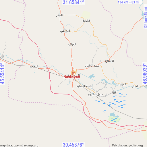
Nasiriyah GPS coordinates[2]
31° 3' 28.764" North, 46° 15' 26.136" East
| Map corner | latitude | longitude |
|---|---|---|
| Upper-left | 31.65841°, | 45.55414° |
| Center: | 31.05799°, | 46.25726° |
| Lower-right: | 30.45376°, | 46.96039° |
| Map W x H: | 133.9×133.9 km | = 83.2×83.2mi |
| max Lat: | 37.22781° ⇑89.4% North |
| Nasiriyah: | 31.05799° |
| min Lat: | ⇓10.6% South 29.97421° |
| min Long | Nasiriyah | max Long |
| 40.28586° | 46.25726° | 48.47309° |
| W 85.9%⇐ | ⇒14.1% E |
Elevation
Elevation of Nasiriyah is 7 m = 23 ft, and this is 286 m = 938 ft below average elevation for this country.
| Max E: |
1316 m = 4318 ft | 91.5% |
| Avg. | 293 m = 961 ft | |
| Nasiriyah | 7 m = 23 ft | |
Min E: |
1 m = 3 ft | 8.5% |
See also: Nasiriyah elevation on elevation.city.
Geographical zone
Nasiriyah is located in North temperate zone (between Tropic of Cancer and the Arctic Circle). Distance of this Northern Tropic circle is 847.4 km =526.5 mi to South.| Distance of | km | miles | from Nasiriyah |
|---|---|---|---|
| North Pole | 6553.7 | 4072.3 | to North |
| Arctic Circle | 3947.8 | 2453 | to North |
| Tropic Cancer | 847.4 | 526.5 | to South |
| Equator | 3453.3 | 2145.8 | to South |


Nearby cities:
15 places around Nasiriyah: (largest is in red/bold)
• Al Jabāyish
71.7 km =44.6 mi,  98°
98°
• Al Kaḩlā’
119.6 km =74.3 mi,  55°
55°
• Al Madīnah
97.1 km =60.3 mi, 96°
• Al Maymūnah
96.6 km =60 mi,  44°
44°
• Al Qurnah
112.2 km =69.7 mi,  92°
92°
• Al Ḩayy
125.8 km =78.2 mi,  350°
350°
• Al ‘Amārah
120.7 km =75 mi, 44°
• Ar Rifā‘ī
75 km =46.6 mi, 349°
• Ar Rumaythah
112.9 km =70.2 mi,  297°
297°
• As Samawah
96.5 km =60 mi,  288°
288°
• Ash Shaţrah
39.9 km =24.8 mi, 348°
• Nāḩiyat Alī ash Sharqī
127.2 km =79 mi,  21°
21°
• Nāḩiyat al Fuhūd
45.4 km =28.2 mi, 102°
• Qal‘at Şāliḩ
111.5 km =69.3 mi, 62°
• Sūq ash Shuyūkh
26.4 km =16.4 mi,  134°
134°
In other languages:
- In Spanish: Nasiriya
- In German: Nasiriyya
- In Italian: Nasiriya
- In Russian: Насирия
Sources, notices
• [Note1] Compared only with cities in Iraq existing in our database
• [Src1] Map data: © OpenStreetMap contributors (CC-BY-SA)
• [Src2] Other city data from geonames.org with taken over terms of usage.
• [Src3] Geographical zone / Annual Mean Temperature by Robert A. Rohde @ Wikipedia
