Al Ḩayy geodata
Al Ḩayy (Wāsiţ) is a seat of a second-order administrative division; located in Iraq in Asia/Baghdad (GMT+3) time zone. With population of 78,272 people, there are 31 cities with bigger population in this country. Compared to other cities in Iraq, 75.4% of cities are located further ↑North; 83.8% of cities are located further ←West and 81.7% of cities have higher elevation than Al Ḩayy. Note1


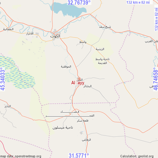
Al Ḩayy GPS coordinates[2]
32° 10' 27.084" North, 46° 2' 36.42" East
| Map corner | latitude | longitude |
|---|---|---|
| Upper-left | 32.76739°, | 45.34033° |
| Center: | 32.17419°, | 46.04345° |
| Lower-right: | 31.5771°, | 46.74658° |
| Map W x H: | 132.3×132.3 km | = 82.2×82.2mi |
| max Lat: | 37.22781° ⇑75.4% North |
| Al Ḩayy: | 32.17419° |
| min Lat: | ⇓24.6% South 29.97421° |
| min Long | Al Ḩayy | max Long |
| 40.28586° | 46.04345° | 48.47309° |
| W 83.8%⇐ | ⇒16.2% E |
Elevation
Elevation of Al Ḩayy is 20 m = 66 ft, and this is 273 m = 896 ft below average elevation for this country.
| Max E: |
1316 m = 4318 ft | 81.7% |
| Avg. | 293 m = 961 ft | |
| Al Ḩayy | 20 m = 66 ft | |
Min E: |
1 m = 3 ft | 18.3% |
See also: Al Ḩayy elevation on elevation.city.
Geographical zone
Al Ḩayy is located in North temperate zone (between Tropic of Cancer and the Arctic Circle). Distance of this Northern Tropic circle is 971.5 km =603.7 mi to South.| Distance of | km | miles | from Al Ḩayy |
|---|---|---|---|
| North Pole | 6429.6 | 3995.2 | to North |
| Arctic Circle | 3823.7 | 2375.9 | to North |
| Tropic Cancer | 971.5 | 603.7 | to South |
| Equator | 3577.4 | 2222.9 | to South |


Nearby cities:
15 places around Al Ḩayy: (largest is in red/bold)
• Ad Dīwānīyah
107.2 km =66.6 mi,  259°
259°
• Al Kūt
43.2 km =26.8 mi,  330°
330°
• Al Maymūnah
103.3 km =64.2 mi,  122°
122°
• Al Ḩamzah
112.4 km =69.8 mi,  243°
243°
• Al ‘Amārah
110.5 km =68.7 mi,  109°
109°
• Al ‘Azīzīyah
123 km =76.4 mi,  311°
311°
• An Nu‘mānīyah
72.9 km =45.3 mi, 305°
• Ar Rifā‘ī
50.8 km =31.6 mi,  173°
173°
• Ar Rumaythah
107 km =66.5 mi,  227°
227°
• As Samawah
117.4 km =72.9 mi,  217°
217°
• Ash Shaţrah
85.9 km =53.4 mi, 171°
• Badrah
105.1 km =65.3 mi,  354°
354°
• Nāḩiyat Alī ash Sharqī
66.7 km =41.4 mi,  94°
94°
• ‘Afak
76 km =47.2 mi, 260°
• ‘Alī al Gharbī
68.5 km =42.6 mi,  62°
62°
Sources, notices
• [Note1] Compared only with cities in Iraq existing in our database
• [Src1] Map data: © OpenStreetMap contributors (CC-BY-SA)
• [Src2] Other city data from geonames.org with taken over terms of usage.
• [Src3] Geographical zone / Annual Mean Temperature by Robert A. Rohde @ Wikipedia
