Ash Shaţrah geodata
Ash Shaţrah (Dhi Qar) is a seat of a second-order administrative division; located in Iraq in Asia/Baghdad (GMT+3) time zone. With population of 82,732 people, there are 30 cities with bigger population in this country. Compared to other cities in Iraq, 88% of cities are located further ↑North; 85.2% of cities are located further ←West and 87.3% of cities have higher elevation than Ash Shaţrah. Note1


Ash Shaţrah GPS coordinates[2]
31° 24' 32.616" North, 46° 10' 21.72" East
| Map corner | latitude | longitude |
|---|---|---|
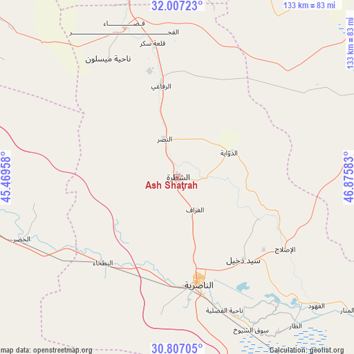
| Upper-left | 32.00723°, | 45.46958° |
| Center: | 31.40906°, | 46.1727° |
| Lower-right: | 30.80705°, | 46.87583° |
| Map W x H: | 133.4×133.4 km | = 82.9×82.9mi |
| max Lat: | 37.22781° ⇑88% North |
| Ash Shaţrah: | 31.40906° |
| min Lat: | ⇓12% South 29.97421° |
| min Long | Ash Shaţrah | max Long |
| 40.28586° | 46.1727° | 48.47309° |
| W 85.2%⇐ | ⇒14.8% E |
Elevation
Elevation of Ash Shaţrah is 13 m = 43 ft, and this is 280 m = 919 ft below average elevation for this country.
| Max E: |
1316 m = 4318 ft | 87.3% |
| Avg. | 293 m = 961 ft | |
| Ash Shaţrah | 13 m = 43 ft | |
Min E: |
1 m = 3 ft | 12.7% |
See also: Ash Shaţrah elevation on elevation.city.
Geographical zone
Ash Shaţrah is located in North temperate zone (between Tropic of Cancer and the Arctic Circle). Distance of this Northern Tropic circle is 886.4 km =550.8 mi to South.| Distance of | km | miles | from Ash Shaţrah |
|---|---|---|---|
| North Pole | 6514.7 | 4048 | to North |
| Arctic Circle | 3908.8 | 2428.8 | to North |
| Tropic Cancer | 886.4 | 550.8 | to South |
| Equator | 3492.4 | 2170.1 | to South |


Nearby cities:
15 places around Ash Shaţrah: (largest is in red/bold)
• Al Jabāyish
93 km =57.8 mi,  121°
121°
• Al Kaḩlā’
110.1 km =68.4 mi,  74°
74°
• Al Madīnah
115.5 km =71.8 mi, 115°
• Al Maymūnah
81.2 km =50.5 mi, 68°
• Al Ḩayy
85.9 km =53.4 mi,  351°
351°
• Al ‘Amārah
103.5 km =64.3 mi,  62°
62°
• Ar Rifā‘ī
35.2 km =21.9 mi, 349°
• Ar Rumaythah
92.8 km =57.7 mi,  278°
278°
• As Samawah
83.8 km =52.1 mi,  264°
264°
• Nasiriyah
39.9 km =24.8 mi,  168°
168°
• Nāḩiyat Alī ash Sharqī
96.3 km =59.8 mi,  34°
34°
• Nāḩiyat al Fuhūd
71.6 km =44.5 mi,  133°
133°
• Qal‘at Şāliḩ
107.1 km =66.5 mi,  82°
82°
• Sūq ash Shuyūkh
63.5 km =39.5 mi,  155°
155°
• ‘Afak
113.9 km =70.8 mi,  309°
309°
Sources, notices
• [Note1] Compared only with cities in Iraq existing in our database
• [Src1] Map data: © OpenStreetMap contributors (CC-BY-SA)
• [Src2] Other city data from geonames.org with taken over terms of usage.
• [Src3] Geographical zone / Annual Mean Temperature by Robert A. Rohde @ Wikipedia
