Nāḩiyat Alī ash Sharqī geodata
Nāḩiyat Alī ash Sharqī (Maysan) is a seat of a third-order administrative division; located in Iraq in Asia/Baghdad (GMT+3) time zone. In our database, there are 71 cities with bigger population. Compared to other cities in Iraq, 76.1% of cities are located further ↑North; 88.7% of cities are located further ←West and 93.7% of cities have higher elevation than Nāḩiyat Alī ash Sharqī. Note1
Current local time in Nāḩiyat Alī ash Sharqī:
09:29 AM, WednesdayDifference from your time zone: hours


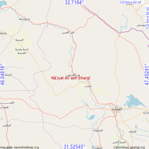
Nāḩiyat Alī ash Sharqī GPS coordinates[2]
32° 7' 22.332" North, 46° 44' 57.408" East
| Map corner | latitude | longitude |
|---|---|---|
| Upper-left | 32.7164°, | 46.04616° |
| Center: | 32.12287°, | 46.74928° |
| Lower-right: | 31.52545°, | 47.45241° |
| Map W x H: | 132.4×132.4 km | = 82.3×82.3mi |
| max Lat: | 37.22781° ⇑76.1% North |
| Nāḩiyat Alī ash Sharqī: | 32.12287° |
| min Lat: | ⇓23.9% South 29.97421° |
| min Long | Nāḩiyat Alī | max Long |
| 40.28586° | 46.74928° | 48.47309° |
| W 88.7%⇐ | ⇒11.3% E |
Elevation
Elevation of Nāḩiyat Alī ash Sharqī is 6 m = 20 ft, and this is 287 m = 942 ft below average elevation for this country.
| Max E: |
1316 m = 4318 ft | 93.7% |
| Avg. | 293 m = 961 ft | |
| Nāḩiyat Alī ash Sharqī | 6 m = 20 ft | |
Min E: |
1 m = 3 ft | 6.3% |
See also: Iraq elevation on elevation.city.
Geographical zone
Nāḩiyat Alī ash Sharqī is located in North temperate zone (between Tropic of Cancer and the Arctic Circle). Distance of this Northern Tropic circle is 965.8 km =600.1 mi to South.| Distance of | km | miles | from Nāḩiyat Alī ash Sharqī |
|---|---|---|---|
| North Pole | 6435.3 | 3998.7 | to North |
| Arctic Circle | 3829.4 | 2379.5 | to North |
| Tropic Cancer | 965.8 | 600.1 | to South |
| Equator | 3571.7 | 2219.4 | to South |


Nearby cities:
15 places around Nāḩiyat Alī ash Sharqī: (largest is in red/bold)
• Al Jabāyish
130.9 km =81.3 mi,  169°
169°
• Al Kaḩlā’
72.2 km =44.9 mi,  134°
134°
• Al Kūt
97.6 km =60.6 mi,  296°
296°
• Al Madīnah
138.1 km =85.8 mi,  159°
159°
• Al Maymūnah
53.6 km =33.3 mi, 157°
• Al Ḩayy
66.7 km =41.4 mi,  274°
274°
• Al ‘Amārah
49.1 km =30.5 mi, 130°
• An Nu‘mānīyah
134.5 km =83.6 mi,  290°
290°
• Ar Rifā‘ī
75.3 km =46.8 mi,  233°
233°
• Ash Shaţrah
96.3 km =59.8 mi,  214°
214°
• Badrah
134.2 km =83.4 mi,  325°
325°
• Nasiriyah
127.2 km =79 mi,  201°
201°
• Nāḩiyat al Fuhūd
128.2 km =79.7 mi,  181°
181°
• Qal‘at Şāliḩ
83.8 km =52.1 mi,  142°
142°
• ‘Alī al Gharbī
38.1 km =23.7 mi,  351°
351°
Sources, notices
• [Note1] Compared only with cities in Iraq existing in our database
• [Src1] Map data: © OpenStreetMap contributors (CC-BY-SA)
• [Src2] Other city data from geonames.org with taken over terms of usage.
• [Src3] Geographical zone / Annual Mean Temperature by Robert A. Rohde @ Wikipedia
