Fereydūnkenār geodata
Fereydūnkenār (Māzandarān) is a seat of a second-order administrative division; located in Iran in Asia/Tehran (GMT+3.5) time zone. With population of 34,097 people, there are 166 cities with bigger population in this country. Compared to other cities in Iran, 77.6% of cities are located further ↓South; 61.5% of cities are located further ←West and 98% of cities have higher elevation than Fereydūnkenār. Note1


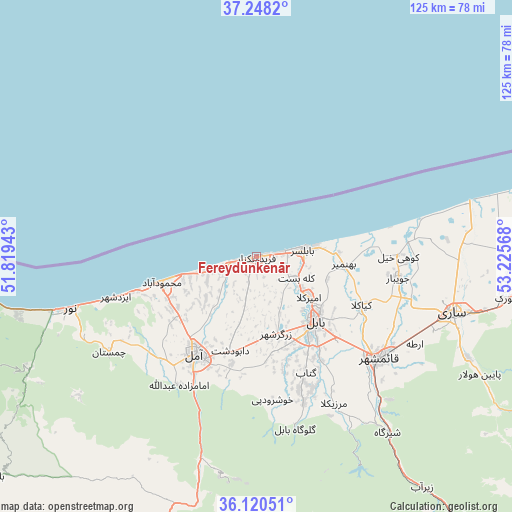
Fereydūnkenār GPS coordinates[2]
36° 41' 11.112" North, 52° 31' 21.18" East
| Map corner | latitude | longitude |
|---|---|---|
| Upper-left | 37.2482°, | 51.81943° |
| Center: | 36.68642°, | 52.52255° |
| Lower-right: | 36.12051°, | 53.22568° |
| Map W x H: | 125.4×125.4 km | = 77.9×77.9mi |
| max Lat: | 39.6482° ⇑22.4% North |
| Fereydūnkenār: | 36.68642° |
| min Lat: | ⇓77.6% South 25.2919° |
| min Long | Fereydūnkenār | max Long |
| 44.38416° | 52.52255° | 61.9965° |
| W 61.5%⇐ | ⇒38.5% E |
Elevation
Elevation of Fereydūnkenār is -18 m = -59 ft, and this is 1067 m = 3501 ft below average elevation for this country.
| Max E: |
2564 m = 8412 ft | 98% |
| Avg. | 1049 m = 3442 ft | |
| Fereydūnkenār | -18 m = -59 ft | |
Min E: |
-24 m = -79 ft | 2% |
See also: Iran elevation on elevation.city.
Geographical zone
Fereydūnkenār is located in North temperate zone (between Tropic of Cancer and the Arctic Circle). Distance of this Northern Tropic circle is 1473.2 km =915.4 mi to South.| Distance of | km | miles | from Fereydūnkenār |
|---|---|---|---|
| North Pole | 5927.9 | 3683.4 | to North |
| Arctic Circle | 3322 | 2064.2 | to North |
| Tropic Cancer | 1473.2 | 915.4 | to South |
| Equator | 4079.1 | 2534.6 | to South |


Nearby cities:
15 places around Fereydūnkenār: (largest is in red/bold)
• Behshahr
91.8 km =57 mi,  89°
89°
• Bābol
20.5 km =12.7 mi,  137°
137°
• Bābolsar
12.2 km =7.6 mi,  81°
81°
• Chālūs
98.4 km =61.1 mi,  267°
267°
• Jūybār
35.1 km =21.8 mi,  98°
98°
• Maḩmūdābād
23.9 km =14.9 mi,  255°
255°
• Nekā
69.4 km =43.1 mi, 93°
• Nowshahr
91.6 km =56.9 mi, 267°
• Nūr
47 km =29.2 mi,  254°
254°
• Pol-e Sefīd
79.2 km =49.2 mi, 142°
• Qā’em Shahr
40 km =24.9 mi,  124°
124°
• Sari
49.9 km =31 mi,  105°
105°
• Soleh Bon
102.1 km =63.4 mi,  178°
178°
• Sūrak
62 km =38.5 mi, 99°
• Āmol
28.6 km =17.8 mi,  212°
212°
Sources, notices
• [Note1] Compared only with cities in Iran existing in our database
• [Src1] Map data: © OpenStreetMap contributors (CC-BY-SA)
• [Src2] Other city data from geonames.org with taken over terms of usage.
• [Src3] Geographical zone / Annual Mean Temperature by Robert A. Rohde @ Wikipedia
