Nowshahr geodata
Nowshahr (Māzandarān) is a seat of a second-order administrative division; located in Iran in Asia/Tehran (GMT+3.5) time zone. With population of 40,000 people, there are 153 cities with bigger population in this country. Compared to other cities in Iran, 76.4% of cities are located further ↓South; 52.6% of cities are located further ←West and 97.5% of cities have higher elevation than Nowshahr. Note1


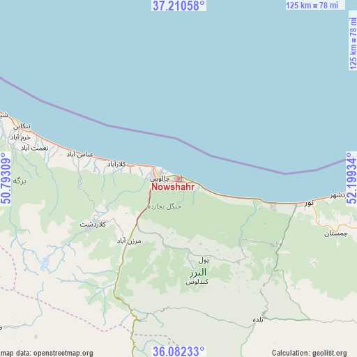
Nowshahr GPS coordinates[2]
36° 38' 54.672" North, 51° 29' 46.356" East
| Map corner | latitude | longitude |
|---|---|---|
| Upper-left | 37.21058°, | 50.79309° |
| Center: | 36.64852°, | 51.49621° |
| Lower-right: | 36.08233°, | 52.19934° |
| Map W x H: | 125.4×125.4 km | = 77.9×77.9mi |
| max Lat: | 39.6482° ⇑23.6% North |
| Nowshahr: | 36.64852° |
| min Lat: | ⇓76.4% South 25.2919° |
| min Long | Nowshahr | max Long |
| 44.38416° | 51.49621° | 61.9965° |
| W 52.6%⇐ | ⇒47.4% E |
Elevation
Elevation of Nowshahr is -17 m = -56 ft, and this is 1066 m = 3497 ft below average elevation for this country.
| Max E: |
2564 m = 8412 ft | 97.5% |
| Avg. | 1049 m = 3442 ft | |
| Nowshahr | -17 m = -56 ft | |
Min E: |
-24 m = -79 ft | 2.5% |
See also: Nowshahr elevation on elevation.city.
Geographical zone
Nowshahr is located in North temperate zone (between Tropic of Cancer and the Arctic Circle). Distance of this Northern Tropic circle is 1469 km =912.8 mi to South.| Distance of | km | miles | from Nowshahr |
|---|---|---|---|
| North Pole | 5932.1 | 3686 | to North |
| Arctic Circle | 3326.2 | 2066.8 | to North |
| Tropic Cancer | 1469 | 912.8 | to South |
| Equator | 4074.9 | 2532 | to South |


Nearby cities:
15 places around Nowshahr: (largest is in red/bold)
• Bābol
106.1 km =65.9 mi,  95°
95°
• Bābolsar
103.7 km =64.4 mi,  86°
86°
• Chālūs
6.8 km =4.2 mi,  276°
276°
• Fereydūnkenār
91.6 km =56.9 mi, 87°
• Hashtgerd
105.7 km =65.7 mi,  223°
223°
• Karaj
101.4 km =63 mi,  206°
206°
• Maḩmūdābād
68.4 km =42.5 mi, 91°
• Nashtārūd
43.6 km =27.1 mi,  285°
285°
• Nūr
47.1 km =29.3 mi, 100°
• Rāmsar
81.3 km =50.5 mi, 291°
• Shahrak
83.7 km =52 mi,  230°
230°
• Tajrīsh
94.1 km =58.5 mi,  183°
183°
• Tonekābon
58.5 km =36.4 mi, 288°
• Āmol
78.9 km =49 mi, 104°
• ‘Abbāsābād
35.9 km =22.3 mi, 284°
Sources, notices
• [Note1] Compared only with cities in Iran existing in our database
• [Src1] Map data: © OpenStreetMap contributors (CC-BY-SA)
• [Src2] Other city data from geonames.org with taken over terms of usage.
• [Src3] Geographical zone / Annual Mean Temperature by Robert A. Rohde @ Wikipedia
