Nūr geodata
Nūr (Māzandarān) is a seat of a second-order administrative division; located in Iran in Asia/Tehran (GMT+3.5) time zone. In our database, there are 232 cities with bigger population. Compared to other cities in Iran, 75.1% of cities are located further ↓South; 59% of cities are located further ←West and 98% of cities have higher elevation than Nūr. Note1


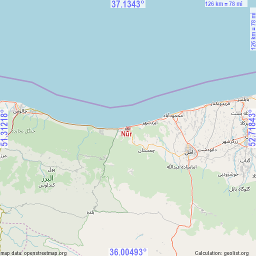
Nūr GPS coordinates[2]
36° 34' 18.048" North, 52° 0' 55.08" East
| Map corner | latitude | longitude |
|---|---|---|
| Upper-left | 37.1343°, | 51.31218° |
| Center: | 36.57168°, | 52.0153° |
| Lower-right: | 36.00493°, | 52.71843° |
| Map W x H: | 125.6×125.6 km | = 78×78mi |
| max Lat: | 39.6482° ⇑24.9% North |
| Nūr: | 36.57168° |
| min Lat: | ⇓75.1% South 25.2919° |
| min Long | Nūr | max Long |
| 44.38416° | 52.0153° | 61.9965° |
| W 59%⇐ | ⇒41% E |
Elevation
Elevation of Nūr is -18 m = -59 ft, and this is 1067 m = 3501 ft below average elevation for this country.
| Max E: |
2564 m = 8412 ft | 98% |
| Avg. | 1049 m = 3442 ft | |
| Nūr | -18 m = -59 ft | |
Min E: |
-24 m = -79 ft | 2% |
See also: Iran elevation on elevation.city.
Geographical zone
Nūr is located in North temperate zone (between Tropic of Cancer and the Arctic Circle). Distance of this Northern Tropic circle is 1460.5 km =907.5 mi to South.| Distance of | km | miles | from Nūr |
|---|---|---|---|
| North Pole | 5940.7 | 3691.4 | to North |
| Arctic Circle | 3334.8 | 2072.1 | to North |
| Tropic Cancer | 1460.5 | 907.5 | to South |
| Equator | 4066.4 | 2526.7 | to South |


Nearby cities:
15 places around Nūr: (largest is in red/bold)
• Bābol
59.3 km =36.8 mi,  92°
92°
• Bābolsar
59.1 km =36.7 mi,  75°
75°
• Chālūs
53.9 km =33.5 mi,  279°
279°
• Damāvand
95 km =59 mi,  177°
177°
• Fereydūnkenār
47 km =29.2 mi,  74°
74°
• Jūybār
80.4 km =50 mi, 84°
• Maḩmūdābād
23.1 km =14.4 mi, 73°
• Nashtārūd
90.7 km =56.4 mi, 282°
• Nowshahr
47.1 km =29.3 mi, 280°
• Qā’em Shahr
78.9 km =49 mi,  97°
97°
• Sari
93.3 km =58 mi, 90°
• Soleh Bon
101.9 km =63.3 mi,  151°
151°
• Tajrīsh
100.4 km =62.4 mi,  211°
211°
• Āmol
32 km =19.9 mi,  110°
110°
• ‘Abbāsābād
83 km =51.6 mi, 282°
Sources, notices
• [Note1] Compared only with cities in Iran existing in our database
• [Src1] Map data: © OpenStreetMap contributors (CC-BY-SA)
• [Src2] Other city data from geonames.org with taken over terms of usage.
• [Src3] Geographical zone / Annual Mean Temperature by Robert A. Rohde @ Wikipedia
