Pol-e Sefīd geodata
Pol-e Sefīd (Māzandarān) is a seat of a second-order administrative division; located in Iran in Asia/Tehran (GMT+3.5) time zone. In our database, there are 232 cities with bigger population. Compared to other cities in Iran, 69.4% of cities are located further ↓South; 65.5% of cities are located further ←West and 72.3% of cities have higher elevation than Pol-e Sefīd. Note1


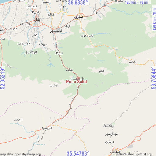
Pol-e Sefīd GPS coordinates[2]
36° 7' 4.332" North, 53° 3' 19.116" East
| Map corner | latitude | longitude |
|---|---|---|
| Upper-left | 36.6838°, | 52.35219° |
| Center: | 36.11787°, | 53.05531° |
| Lower-right: | 35.54783°, | 53.75844° |
| Map W x H: | 126.3×126.3 km | = 78.5×78.5mi |
| max Lat: | 39.6482° ⇑30.6% North |
| Pol-e Sefīd: | 36.11787° |
| min Lat: | ⇓69.4% South 25.2919° |
| min Long | Pol-e Sefīd | max Long |
| 44.38416° | 53.05531° | 61.9965° |
| W 65.5%⇐ | ⇒34.5% E |
Elevation
Elevation of Pol-e Sefīd is 560 m = 1837 ft, and this is 489 m = 1604 ft below average elevation for this country.
| Max E: |
2564 m = 8412 ft | 72.3% |
| Avg. | 1049 m = 3442 ft | |
| Pol-e Sefīd | 560 m = 1837 ft | |
Min E: |
-24 m = -79 ft | 27.7% |
See also: Iran elevation on elevation.city.
Geographical zone
Pol-e Sefīd is located in North temperate zone (between Tropic of Cancer and the Arctic Circle). Distance of this Northern Tropic circle is 1410 km =876.1 mi to South.| Distance of | km | miles | from Pol-e Sefīd |
|---|---|---|---|
| North Pole | 5991.1 | 3722.7 | to North |
| Arctic Circle | 3385.2 | 2103.5 | to North |
| Tropic Cancer | 1410 | 876.1 | to South |
| Equator | 4015.9 | 2495.4 | to South |


Nearby cities:
15 places around Pol-e Sefīd: (largest is in red/bold)
• Behshahr
77.9 km =48.4 mi,  34°
34°
• Bābol
58.8 km =36.5 mi,  325°
325°
• Bābolsar
74.1 km =46 mi, 331°
• Fereydūnkenār
79.2 km =49.2 mi,  322°
322°
• Fīrūzkūh
47.6 km =29.6 mi,  212°
212°
• Jūybār
59.6 km =37 mi,  347°
347°
• Mahdishahr
52.7 km =32.7 mi,  149°
149°
• Nekā
63.1 km =39.2 mi,  20°
20°
• Qā’em Shahr
43 km =26.7 mi,  339°
339°
• Sari
49.5 km =30.8 mi,  0°
0°
• Semnan
67.4 km =41.9 mi, 153°
• Soleh Bon
59.1 km =36.7 mi,  228°
228°
• Sorkheh
74.2 km =46.1 mi,  168°
168°
• Sūrak
54.8 km =34.1 mi,  14°
14°
• Āmol
74.3 km =46.2 mi,  301°
301°
Sources, notices
• [Note1] Compared only with cities in Iran existing in our database
• [Src1] Map data: © OpenStreetMap contributors (CC-BY-SA)
• [Src2] Other city data from geonames.org with taken over terms of usage.
• [Src3] Geographical zone / Annual Mean Temperature by Robert A. Rohde @ Wikipedia
