San Nicolo'Gerrei geodata
San Nicolo'Gerrei (Sardinia) is a seat of a third-order administrative division; located in Italy in Europe/Rome (GMT+2) time zone. With population of 828 people, there are 7513 cities with bigger population in this country. Compared to other cities in Italy, 90.4% of cities are located further ↑North; 76.2% of cities are located further →East and 68.9% of cities have lower elevation than San Nicolo'Gerrei. Note1
Administrative division(s):
- Level 1: Sardinia
- Level 2: Provincia del Sud Sardegna
- Level 3: San Nicolò Gerrei


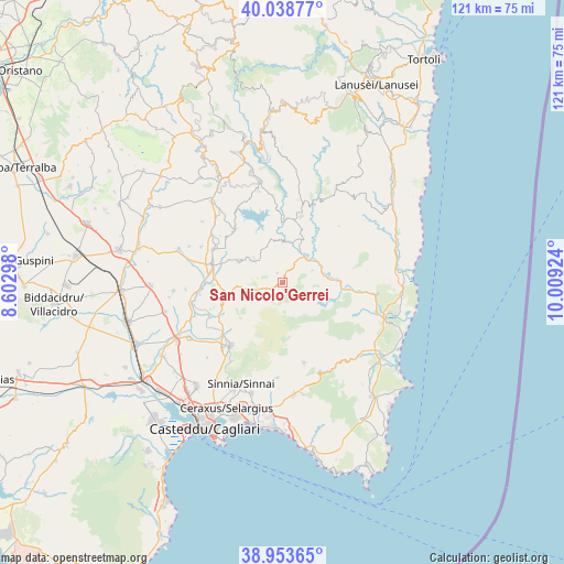
San Nicolo'Gerrei GPS coordinates[2]
39° 29' 53.988" North, 9° 18' 21.996" East
| Map corner | latitude | longitude |
|---|---|---|
| Upper-left | 40.03877°, | 8.60298° |
| Center: | 39.49833°, | 9.30611° |
| Lower-right: | 38.95365°, | 10.00924° |
| Map W x H: | 120.7×120.7 km | = 75×75mi |
| max Lat: | 47.04031° ⇑90.4% North |
| San Nicolo'Gerrei: | 39.49833° |
| min Lat: | ⇓9.6% South 35.50142° |
| min Long | San Nicolo'Gerr | max Long |
| 6.69888° | 9.30611° | 18.48682° |
| W 23.8%⇐ | ⇒76.2% E |
Elevation
Elevation of San Nicolo'Gerrei is 383 m = 1257 ft, and this is 76.3 m = 250 ft above average elevation for this country.
| Max E: |
2085 m = 6841 ft | 31.1% |
| San Nicolo'Gerrei | 383 m 1257 ft | |
| Avg. | 306.7 m = 1006 ft | |
Min E: |
-4 m = -13 ft | 68.9% |
See also: Italy elevation on elevation.city.
Geographical zone
San Nicolo'Gerrei is located in North temperate zone (between Tropic of Cancer and the Arctic Circle). Distance of this Northern Tropic circle is 1785.9 km =1109.7 mi to South.| Distance of | km | miles | from San Nicolo'Gerrei |
|---|---|---|---|
| North Pole | 5615.3 | 3489.2 | to North |
| Arctic Circle | 3009.4 | 1870 | to North |
| Tropic Cancer | 1785.9 | 1109.7 | to South |
| Equator | 4391.8 | 2728.9 | to South |


Nearby cities:
15 places around San Nicolo'Gerrei: (largest is in red/bold)
• Armungia
6.9 km =4.3 mi,  68°
68°
• Ballao
7.4 km =4.6 mi,  40°
40°
• Barrali
17.7 km =11 mi,  261°
261°
• Burcei
17.8 km =11.1 mi,  164°
164°
• Dolianova
17.4 km =10.8 mi,  219°
219°
• Donorì
17.1 km =10.6 mi,  244°
244°
• Escalaplano
14.7 km =9.1 mi,  16°
16°
• Goni
9.2 km =5.7 mi,  348°
348°
• San Basilio
10.3 km =6.4 mi,  295°
295°
• Sant'Andrea Frius
11.9 km =7.4 mi, 259°
• Senorbì
15.5 km =9.6 mi,  284°
284°
• Silius
2.3 km =1.4 mi,  332°
332°
• Siurgus Donigala
15.2 km =9.4 mi,  317°
317°
• Suelli
16.5 km =10.3 mi, 295°
• Villasalto
7.3 km =4.5 mi,  95°
95°
Sources, notices
• [Note1] Compared only with cities in Italy existing in our database
• [Src1] Map data: © OpenStreetMap contributors (CC-BY-SA)
• [Src2] Other city data from geonames.org with taken over terms of usage.
• [Src3] Geographical zone / Annual Mean Temperature by Robert A. Rohde @ Wikipedia
