Escalaplano geodata
Escalaplano (Sardinia) is a seat of a third-order administrative division; located in Italy in Europe/Rome (GMT+2) time zone. With population of 2,220 people, there are 3846 cities with bigger population in this country. Compared to other cities in Italy, 89.8% of cities are located further ↑North; 75.4% of cities are located further →East and 65.3% of cities have lower elevation than Escalaplano. Note1
Administrative division(s):
- Level 1: Sardinia
- Level 2: Provincia del Sud Sardegna
- Level 3: Escalaplano


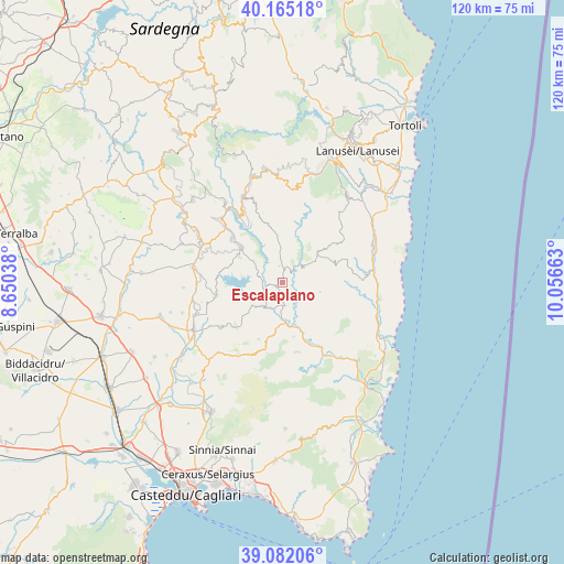
Escalaplano GPS coordinates[2]
39° 37' 32.664" North, 9° 21' 12.6" East
| Map corner | latitude | longitude |
|---|---|---|
| Upper-left | 40.16518°, | 8.65038° |
| Center: | 39.62574°, | 9.3535° |
| Lower-right: | 39.08206°, | 10.05663° |
| Map W x H: | 120.4×120.4 km | = 74.8×74.8mi |
| max Lat: | 47.04031° ⇑89.8% North |
| Escalaplano: | 39.62574° |
| min Lat: | ⇓10.2% South 35.50142° |
| min Long | Escalaplano | max Long |
| 6.69888° | 9.3535° | 18.48682° |
| W 24.6%⇐ | ⇒75.4% E |
Elevation
Elevation of Escalaplano is 346 m = 1135 ft, and this is 39.3 m = 129 ft above average elevation for this country.
| Max E: |
2085 m = 6841 ft | 34.7% |
| Escalaplano | 346 m 1135 ft | |
| Avg. | 306.7 m = 1006 ft | |
Min E: |
-4 m = -13 ft | 65.3% |
See also: Italy elevation on elevation.city.
Geographical zone
Escalaplano is located in North temperate zone (between Tropic of Cancer and the Arctic Circle). Distance of this Northern Tropic circle is 1800.1 km =1118.5 mi to South.| Distance of | km | miles | from Escalaplano |
|---|---|---|---|
| North Pole | 5601.1 | 3480.4 | to North |
| Arctic Circle | 2995.2 | 1861.1 | to North |
| Tropic Cancer | 1800.1 | 1118.5 | to South |
| Equator | 4406 | 2737.8 | to South |


Nearby cities:
15 places around Escalaplano: (largest is in red/bold)
• Armungia
11.8 km =7.3 mi,  168°
168°
• Ballao
8.5 km =5.3 mi,  175°
175°
• Esterzili
18.2 km =11.3 mi,  340°
340°
• Goni
7.8 km =4.8 mi,  228°
228°
• Mandas
19.5 km =12.1 mi,  279°
279°
• Nurri
14.2 km =8.8 mi,  311°
311°
• Orroli
11.6 km =7.2 mi, 309°
• Perdasdefogu
9.6 km =6 mi,  51°
51°
• San Basilio
16.6 km =10.3 mi, 233°
• San Nicolo'Gerrei
14.7 km =9.1 mi,  196°
196°
• Serri
19.7 km =12.2 mi,  295°
295°
• Silius
13.1 km =8.1 mi, 202°
• Siurgus Donigala
14.5 km =9 mi,  258°
258°
• Suelli
20.2 km =12.6 mi,  249°
249°
• Villasalto
15.2 km =9.4 mi, 168°
Sources, notices
• [Note1] Compared only with cities in Italy existing in our database
• [Src1] Map data: © OpenStreetMap contributors (CC-BY-SA)
• [Src2] Other city data from geonames.org with taken over terms of usage.
• [Src3] Geographical zone / Annual Mean Temperature by Robert A. Rohde @ Wikipedia
