Ballao geodata
Ballao (Sardinia) is a seat of a third-order administrative division; located in Italy in Europe/Rome (GMT+2) time zone. With population of 858 people, there are 7366 cities with bigger population in this country. Compared to other cities in Italy, 90.1% of cities are located further ↑North; 75.2% of cities are located further →East and 70.2% of cities have higher elevation than Ballao. Note1


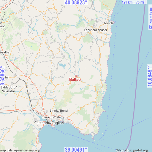
Ballao GPS coordinates[2]
39° 32' 57.084" North, 9° 21' 42.408" East
| Map corner | latitude | longitude |
|---|---|---|
| Upper-left | 40.08923°, | 8.65866° |
| Center: | 39.54919°, | 9.36178° |
| Lower-right: | 39.00491°, | 10.06491° |
| Map W x H: | 120.6×120.6 km | = 74.9×74.9mi |
| max Lat: | 47.04031° ⇑90.1% North |
| Ballao: | 39.54919° |
| min Lat: | ⇓9.9% South 35.50142° |
| min Long | Ballao | max Long |
| 6.69888° | 9.36178° | 18.48682° |
| W 24.8%⇐ | ⇒75.2% E |
Elevation
Elevation of Ballao is 96 m = 315 ft, and this is 210.7 m = 691 ft below average elevation for this country.
| Max E: |
2085 m = 6841 ft | 70.2% |
| Avg. | 306.7 m = 1006 ft | |
| Ballao | 96 m = 315 ft | |
Min E: |
-4 m = -13 ft | 29.8% |
See also: Italy elevation on elevation.city.
Geographical zone
Ballao is located in North temperate zone (between Tropic of Cancer and the Arctic Circle). Distance of this Northern Tropic circle is 1791.5 km =1113.2 mi to South.| Distance of | km | miles | from Ballao |
|---|---|---|---|
| North Pole | 5609.6 | 3485.6 | to North |
| Arctic Circle | 3003.7 | 1866.4 | to North |
| Tropic Cancer | 1791.5 | 1113.2 | to South |
| Equator | 4397.5 | 2732.5 | to South |


Nearby cities:
15 places around Ballao: (largest is in red/bold)
• Armungia
3.5 km =2.2 mi,  152°
152°
• Escalaplano
8.5 km =5.3 mi,  355°
355°
• Goni
7.4 km =4.6 mi,  296°
296°
• Nurri
21.3 km =13.2 mi,  327°
327°
• Orroli
18.6 km =11.6 mi, 328°
• Perdasdefogu
16 km =9.9 mi,  25°
25°
• San Basilio
14.1 km =8.8 mi,  264°
264°
• San Nicolo'Gerrei
7.4 km =4.6 mi,  220°
220°
• San Vito
19.5 km =12.1 mi,  127°
127°
• Sant'Andrea Frius
18.2 km =11.3 mi,  244°
244°
• Senorbì
19.8 km =12.3 mi, 264°
• Silius
6.9 km =4.3 mi, 238°
• Siurgus Donigala
16 km =9.9 mi,  290°
290°
• Suelli
19.7 km =12.2 mi,  274°
274°
• Villasalto
6.8 km =4.2 mi,  158°
158°
Sources, notices
• [Note1] Compared only with cities in Italy existing in our database
• [Src1] Map data: © OpenStreetMap contributors (CC-BY-SA)
• [Src2] Other city data from geonames.org with taken over terms of usage.
• [Src3] Geographical zone / Annual Mean Temperature by Robert A. Rohde @ Wikipedia
