Ortacesus geodata
Ortacesus (Sardinia) is a seat of a third-order administrative division; located in Italy in Europe/Rome (GMT+2) time zone. With population of 916 people, there are 7056 cities with bigger population in this country. Compared to other cities in Italy, 90.2% of cities are located further ↑North; 79.9% of cities are located further →East and 60.8% of cities have higher elevation than Ortacesus. Note1
Administrative division(s):
- Level 1: Sardinia
- Level 2: Provincia del Sud Sardegna
- Level 3: Ortacesus


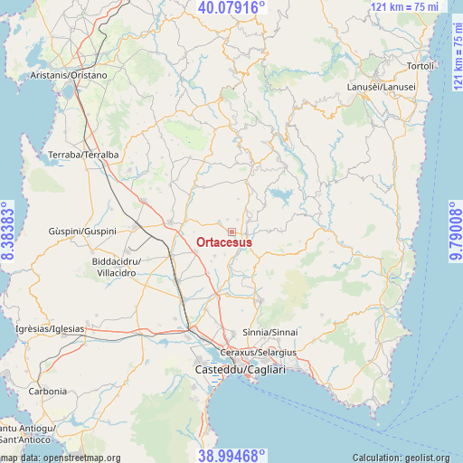
Ortacesus GPS coordinates[2]
39° 32' 20.544" North, 9° 5' 13.02" East
| Map corner | latitude | longitude |
|---|---|---|
| Upper-left | 40.07916°, | 8.38383° |
| Center: | 39.53904°, | 9.08695° |
| Lower-right: | 38.99468°, | 9.79008° |
| Map W x H: | 120.6×120.6 km | = 74.9×74.9mi |
| max Lat: | 47.04031° ⇑90.2% North |
| Ortacesus: | 39.53904° |
| min Lat: | ⇓9.8% South 35.50142° |
| min Long | Ortacesus | max Long |
| 6.69888° | 9.08695° | 18.48682° |
| W 20.1%⇐ | ⇒79.9% E |
Elevation
Elevation of Ortacesus is 157 m = 515 ft, and this is 149.7 m = 491 ft below average elevation for this country.
| Max E: |
2085 m = 6841 ft | 60.8% |
| Avg. | 306.7 m = 1006 ft | |
| Ortacesus | 157 m = 515 ft | |
Min E: |
-4 m = -13 ft | 39.2% |
See also: Italy elevation on elevation.city.
Geographical zone
Ortacesus is located in North temperate zone (between Tropic of Cancer and the Arctic Circle). Distance of this Northern Tropic circle is 1790.4 km =1112.5 mi to South.| Distance of | km | miles | from Ortacesus |
|---|---|---|---|
| North Pole | 5610.7 | 3486.3 | to North |
| Arctic Circle | 3004.8 | 1867.1 | to North |
| Tropic Cancer | 1790.4 | 1112.5 | to South |
| Equator | 4396.3 | 2731.7 | to South |


Nearby cities:
15 places around Ortacesus: (largest is in red/bold)
• Barrali
7.2 km =4.5 mi,  169°
169°
• Furtei
12.2 km =7.6 mi,  282°
282°
• Gesico
8.8 km =5.5 mi,  11°
11°
• Guamaggiore
3.5 km =2.2 mi,  341°
341°
• Guasila
4.3 km =2.7 mi,  302°
302°
• Pimentel
6.1 km =3.8 mi,  197°
197°
• Samatzai
7.7 km =4.8 mi,  215°
215°
• San Basilio
9.5 km =5.9 mi,  90°
90°
• Sant'Andrea Frius
9.8 km =6.1 mi,  133°
133°
• Segariu
9.4 km =5.8 mi,  287°
287°
• Selegas
3.5 km =2.2 mi,  23°
23°
• Senorbì
3.9 km =2.4 mi,  99°
99°
• Serrenti
10.8 km =6.7 mi,  241°
241°
• Siurgus Donigala
10.9 km =6.8 mi,  51°
51°
• Suelli
4.7 km =2.9 mi,  56°
56°
Sources, notices
• [Note1] Compared only with cities in Italy existing in our database
• [Src1] Map data: © OpenStreetMap contributors (CC-BY-SA)
• [Src2] Other city data from geonames.org with taken over terms of usage.
• [Src3] Geographical zone / Annual Mean Temperature by Robert A. Rohde @ Wikipedia
