Zogno geodata
Zogno (Lombardy) is a seat of a third-order administrative division; located in Italy in Europe/Rome (GMT+2) time zone. With population of 5,694 people, there are 1725 cities with bigger population in this country. Compared to other cities in Italy, 85.5% of cities are located further ↓South; 71.2% of cities are located further →East and 62.8% of cities have lower elevation than Zogno. Note1


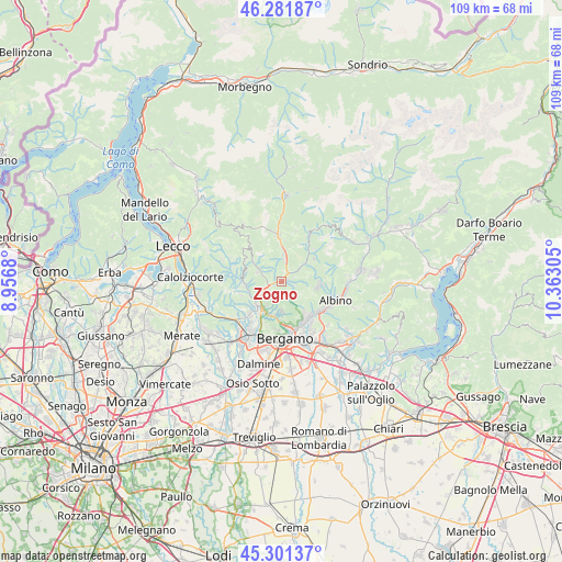
Zogno GPS coordinates[2]
45° 47' 37.608" North, 9° 39' 35.712" East
| Map corner | latitude | longitude |
|---|---|---|
| Upper-left | 46.28187°, | 8.9568° |
| Center: | 45.79378°, | 9.65992° |
| Lower-right: | 45.30137°, | 10.36305° |
| Map W x H: | 109×109 km | = 67.7×67.7mi |
| max Lat: | 47.04031° ⇑14.5% North |
| Zogno: | 45.79378° |
| min Lat: | ⇓85.5% South 35.50142° |
| min Long | Zogno | max Long |
| 6.69888° | 9.65992° | 18.48682° |
| W 28.8%⇐ | ⇒71.2% E |
Elevation
Elevation of Zogno is 322 m = 1056 ft, and this is 15.3 m = 50 ft above average elevation for this country.
| Max E: |
2085 m = 6841 ft | 37.2% |
| Zogno | 322 m 1056 ft | |
| Avg. | 306.7 m = 1006 ft | |
Min E: |
-4 m = -13 ft | 62.8% |
See also: Italy elevation on elevation.city.
Geographical zone
Zogno is located in North temperate zone (between Tropic of Cancer and the Arctic Circle). Distance of this North polar circle is 2309.4 km =1435 mi to North.| Distance of | km | miles | from Zogno |
|---|---|---|---|
| North Pole | 4915.3 | 3054.2 | to North |
| Arctic Circle | 2309.4 | 1435 | to North |
| Tropic Cancer | 2485.9 | 1544.7 | to South |
| Equator | 5091.8 | 3163.9 | to South |


Nearby cities:
15 places around Zogno: (largest is in red/bold)
• Algua
6 km =3.7 mi,  53°
53°
• Almenno San Salvatore
6.9 km =4.3 mi,  224°
224°
• Ambria-Spino
2.3 km =1.4 mi,  44°
44°
• Botta
4.6 km =2.9 mi,  230°
230°
• Bracca
4.9 km =3 mi, 49°
• Brembilla
5.8 km =3.6 mi,  302°
302°
• Laxolo
4.9 km =3 mi,  289°
289°
• Ponteranica
6.8 km =4.2 mi,  185°
185°
• Poscante
2.4 km =1.5 mi,  115°
115°
• San Pellegrino Terme
4.6 km =2.9 mi,  7°
7°
• Sedrina
3.2 km =2 mi,  242°
242°
• Strozza
6.7 km =4.2 mi,  249°
249°
• Ubiale
3.6 km =2.2 mi, 251°
• Ubiale Clanezzo
3.3 km =2.1 mi, 250°
• Villa d'Almè
6 km =3.7 mi,  213°
213°
Sources, notices
• [Note1] Compared only with cities in Italy existing in our database
• [Src1] Map data: © OpenStreetMap contributors (CC-BY-SA)
• [Src2] Other city data from geonames.org with taken over terms of usage.
• [Src3] Geographical zone / Annual Mean Temperature by Robert A. Rohde @ Wikipedia
