Ubiale geodata
Ubiale (Lombardy) is a seat of a third-order administrative division; located in Italy in Europe/Rome (GMT+2) time zone. With population of 793 people, there are 7682 cities with bigger population in this country. Compared to other cities in Italy, 85% of cities are located further ↓South; 71.7% of cities are located further →East and 65.9% of cities have lower elevation than Ubiale. Note1
Administrative division(s):
- Level 1: Lombardy
- Level 2: Provincia di Bergamo
- Level 3: Ubiale Clanezzo


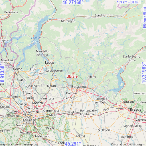
Ubiale GPS coordinates[2]
45° 47' 0.6" North, 9° 36' 59.4" East
| Map corner | latitude | longitude |
|---|---|---|
| Upper-left | 46.27168°, | 8.91338° |
| Center: | 45.7835°, | 9.6165° |
| Lower-right: | 45.291°, | 10.31963° |
| Map W x H: | 109×109 km | = 67.7×67.7mi |
| max Lat: | 47.04031° ⇑15% North |
| Ubiale: | 45.7835° |
| min Lat: | ⇓85% South 35.50142° |
| min Long | Ubiale | max Long |
| 6.69888° | 9.6165° | 18.48682° |
| W 28.3%⇐ | ⇒71.7% E |
Elevation
Elevation of Ubiale is 352 m = 1155 ft, and this is 45.3 m = 149 ft above average elevation for this country.
| Max E: |
2085 m = 6841 ft | 34.1% |
| Ubiale | 352 m 1155 ft | |
| Avg. | 306.7 m = 1006 ft | |
Min E: |
-4 m = -13 ft | 65.9% |
See also: Italy elevation on elevation.city.
Geographical zone
Ubiale is located in North temperate zone (between Tropic of Cancer and the Arctic Circle). Distance of this North polar circle is 2310.5 km =1435.7 mi to North.| Distance of | km | miles | from Ubiale |
|---|---|---|---|
| North Pole | 4916.4 | 3054.9 | to North |
| Arctic Circle | 2310.5 | 1435.7 | to North |
| Tropic Cancer | 2484.7 | 1543.9 | to South |
| Equator | 5090.6 | 3163.2 | to South |


Nearby cities:
15 places around Ubiale: (largest is in red/bold)
• Almenno San Salvatore
4.1 km =2.5 mi,  201°
201°
• Almè
5 km =3.1 mi,  180°
180°
• Bedulita
5.1 km =3.2 mi,  279°
279°
• Berbenno
5 km =3.1 mi,  314°
314°
• Botta
1.8 km =1.1 mi,  185°
185°
• Brembilla
4.5 km =2.8 mi,  340°
340°
• Camoneone
3.7 km =2.3 mi,  273°
273°
• Laxolo
3.1 km =1.9 mi, 335°
• Poscante
5.6 km =3.5 mi,  89°
89°
• Roncola
4.6 km =2.9 mi,  249°
249°
• Sedrina
0.6 km =0.4 mi,  119°
119°
• Strozza
3.1 km =1.9 mi, 248°
• Ubiale Clanezzo
0.2 km =0.1 mi,  84°
84°
• Villa d'Almè
3.9 km =2.4 mi, 179°
• Zogno
3.6 km =2.2 mi,  71°
71°
Sources, notices
• [Note1] Compared only with cities in Italy existing in our database
• [Src1] Map data: © OpenStreetMap contributors (CC-BY-SA)
• [Src2] Other city data from geonames.org with taken over terms of usage.
• [Src3] Geographical zone / Annual Mean Temperature by Robert A. Rohde @ Wikipedia
