Panchià geodata
Panchià (Trentino-Alto Adige) is a seat of a third-order administrative division; located in Italy in Europe/Rome (GMT+2) time zone. With population of 752 people, there are 7941 cities with bigger population in this country. Compared to other cities in Italy, 96.8% of cities are located further ↓South; 50.1% of cities are located further →East and 96.9% of cities have lower elevation than Panchià. Note1
Administrative division(s):
- Level 1: Trentino-Alto Adige
- Level 2: Provincia autonoma di Trento
- Level 3: Panchià


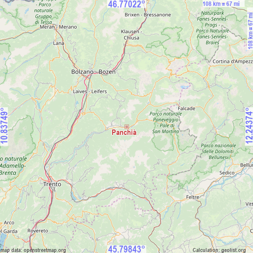
Panchià GPS coordinates[2]
46° 17' 11.328" North, 11° 32' 26.196" East
| Map corner | latitude | longitude |
|---|---|---|
| Upper-left | 46.77022°, | 10.83749° |
| Center: | 46.28648°, | 11.54061° |
| Lower-right: | 45.79843°, | 12.24374° |
| Map W x H: | 108.1×108.1 km | = 67.2×67.2mi |
| max Lat: | 47.04031° ⇑3.2% North |
| Panchià: | 46.28648° |
| min Lat: | ⇓96.8% South 35.50142° |
| min Long | Panchià | max Long |
| 6.69888° | 11.54061° | 18.48682° |
| W 49.9%⇐ | ⇒50.1% E |
Elevation
Elevation of Panchià is 988 m = 3241 ft, and this is 681.3 m = 2235 ft above average elevation for this country.
| Max E: |
2085 m = 6841 ft | 3.1% |
| Panchià | 988 m 3241 ft | |
| Avg. | 306.7 m = 1006 ft | |
Min E: |
-4 m = -13 ft | 96.9% |
See also: Italy elevation on elevation.city.
Geographical zone
Panchià is located in North temperate zone (between Tropic of Cancer and the Arctic Circle). Distance of this North polar circle is 2254.6 km =1400.9 mi to North.| Distance of | km | miles | from Panchià |
|---|---|---|---|
| North Pole | 4860.5 | 3020.2 | to North |
| Arctic Circle | 2254.6 | 1400.9 | to North |
| Tropic Cancer | 2540.7 | 1578.7 | to South |
| Equator | 5146.6 | 3197.9 | to South |


Nearby cities:
15 places around Panchià: (largest is in red/bold)
• Anterivo
13.4 km =8.3 mi,  266°
266°
• Carano
7.8 km =4.8 mi, 274°
• Castello Molina di Fiemme
8.2 km =5.1 mi, 266°
• Cavalese
6.3 km =3.9 mi, 274°
• Daiano
7.2 km =4.5 mi,  283°
283°
• Masi di Cavalese
4.3 km =2.7 mi,  263°
263°
• Moena
13.5 km =8.4 mi,  42°
42°
• Molina
9.6 km =6 mi, 260°
• Predazzo
5.3 km =3.3 mi,  58°
58°
• Soraga
15.4 km =9.6 mi, 38°
• Tesero
2.5 km =1.6 mi, 283°
• Trodena
15.2 km =9.4 mi,  285°
285°
• Valfloriana
15.7 km =9.8 mi,  254°
254°
• Varena
6.7 km =4.2 mi, 289°
• Ziano di Fiemme
1.9 km =1.2 mi,  92°
92°
Sources, notices
• [Note1] Compared only with cities in Italy existing in our database
• [Src1] Map data: © OpenStreetMap contributors (CC-BY-SA)
• [Src2] Other city data from geonames.org with taken over terms of usage.
• [Src3] Geographical zone / Annual Mean Temperature by Robert A. Rohde @ Wikipedia
