Moena geodata
Moena (Trentino-Alto Adige) is a seat of a third-order administrative division; located in Italy in Europe/Rome (GMT+2) time zone. With population of 2,300 people, there are 3759 cities with bigger population in this country. Compared to other cities in Italy, 97.5% of cities are located further ↓South; 51.3% of cities are located further ←West and 98.5% of cities have lower elevation than Moena. Note1
Administrative division(s):
- Level 1: Trentino-Alto Adige
- Level 2: Provincia autonoma di Trento
- Level 3: Moena


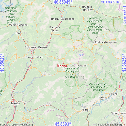
Moena GPS coordinates[2]
46° 22' 35.58" North, 11° 39' 33.876" East
| Map corner | latitude | longitude |
|---|---|---|
| Upper-left | 46.85949°, | 10.95629° |
| Center: | 46.37655°, | 11.65941° |
| Lower-right: | 45.8893°, | 12.36254° |
| Map W x H: | 107.9×107.9 km | = 67×67mi |
| max Lat: | 47.04031° ⇑2.5% North |
| Moena: | 46.37655° |
| min Lat: | ⇓97.5% South 35.50142° |
| min Long | Moena | max Long |
| 6.69888° | 11.65941° | 18.48682° |
| W 51.3%⇐ | ⇒48.7% E |
Elevation
Elevation of Moena is 1175 m = 3855 ft, and this is 868.3 m = 2849 ft above average elevation for this country.
| Max E: |
2085 m = 6841 ft | 1.5% |
| Moena | 1175 m 3855 ft | |
| Avg. | 306.7 m = 1006 ft | |
Min E: |
-4 m = -13 ft | 98.5% |
See also: Italy elevation on elevation.city.
Geographical zone
Moena is located in North temperate zone (between Tropic of Cancer and the Arctic Circle). Distance of this North polar circle is 2244.6 km =1394.7 mi to North.| Distance of | km | miles | from Moena |
|---|---|---|---|
| North Pole | 4850.5 | 3014 | to North |
| Arctic Circle | 2244.6 | 1394.7 | to North |
| Tropic Cancer | 2550.7 | 1584.9 | to South |
| Equator | 5156.6 | 3204.2 | to South |


Nearby cities:
15 places around Moena: (largest is in red/bold)
• Alba-Penia
13.9 km =8.6 mi,  49°
49°
• Campitello di Fassa
12.7 km =7.9 mi,  29°
29°
• Canazei
13.9 km =8.6 mi,  37°
37°
• Falcade Alto
15.3 km =9.5 mi,  98°
98°
• Mazzin
9.5 km =5.9 mi,  19°
19°
• Nova Levante
10.9 km =6.8 mi,  302°
302°
• Panchià
13.5 km =8.4 mi,  222°
222°
• Pera
7.6 km =4.7 mi, 19°
• Pozza di Fassa
6.1 km =3.8 mi, 20°
• Predazzo
8.6 km =5.3 mi,  212°
212°
• Soraga
2.1 km =1.3 mi,  14°
14°
• Tesero
14.9 km =9.3 mi,  230°
230°
• Tires
14.4 km =8.9 mi,  315°
315°
• Vigo di Fassa
4.9 km =3 mi, 13°
• Ziano di Fiemme
12.4 km =7.7 mi, 215°
Sources, notices
• [Note1] Compared only with cities in Italy existing in our database
• [Src1] Map data: © OpenStreetMap contributors (CC-BY-SA)
• [Src2] Other city data from geonames.org with taken over terms of usage.
• [Src3] Geographical zone / Annual Mean Temperature by Robert A. Rohde @ Wikipedia
