Vigo di Fassa geodata
Vigo di Fassa (Trentino-Alto Adige) is a seat of a third-order administrative division; located in Italy in Europe/Rome (GMT+2) time zone. With population of 1,036 people, there are 6522 cities with bigger population in this country. Compared to other cities in Italy, 97.8% of cities are located further ↓South; 51.5% of cities are located further ←West and 99.4% of cities have lower elevation than Vigo di Fassa. Note1
Administrative division(s):
- Level 1: Trentino-Alto Adige
- Level 2: Provincia autonoma di Trento
- Level 3: Sèn Jan di Fassa


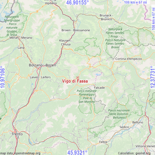
Vigo di Fassa GPS coordinates[2]
46° 25' 8.328" North, 11° 40' 27.048" East
| Map corner | latitude | longitude |
|---|---|---|
| Upper-left | 46.90155°, | 10.97106° |
| Center: | 46.41898°, | 11.67418° |
| Lower-right: | 45.9321°, | 12.37731° |
| Map W x H: | 107.8×107.8 km | = 67×67mi |
| max Lat: | 47.04031° ⇑2.2% North |
| Vigo di Fassa: | 46.41898° |
| min Lat: | ⇓97.8% South 35.50142° |
| min Long | Vigo di Fassa | max Long |
| 6.69888° | 11.67418° | 18.48682° |
| W 51.5%⇐ | ⇒48.5% E |
Elevation
Elevation of Vigo di Fassa is 1374 m = 4508 ft, and this is 1067.3 m = 3502 ft above average elevation for this country.
| Max E: |
2085 m = 6841 ft | 0.59999999999999% |
| Vigo di Fassa | 1374 m 4508 ft | |
| Avg. | 306.7 m = 1006 ft | |
Min E: |
-4 m = -13 ft | 99.4% |
See also: Italy elevation on elevation.city.
Geographical zone
Vigo di Fassa is located in North temperate zone (between Tropic of Cancer and the Arctic Circle). Distance of this North polar circle is 2239.9 km =1391.8 mi to North.| Distance of | km | miles | from Vigo di Fassa |
|---|---|---|---|
| North Pole | 4845.8 | 3011 | to North |
| Arctic Circle | 2239.9 | 1391.8 | to North |
| Tropic Cancer | 2555.4 | 1587.9 | to South |
| Equator | 5161.3 | 3207.1 | to South |


Nearby cities:
15 places around Vigo di Fassa: (largest is in red/bold)
• Alba-Penia
10.4 km =6.5 mi,  65°
65°
• Campitello di Fassa
8.1 km =5 mi,  39°
39°
• Canazei
9.7 km =6 mi,  48°
48°
• Falcade Alto
15.7 km =9.8 mi,  116°
116°
• Mazzin
4.7 km =2.9 mi,  24°
24°
• Moena
4.9 km =3 mi,  193°
193°
• Nova Levante
10.4 km =6.5 mi,  276°
276°
• Pera
2.9 km =1.8 mi,  30°
30°
• Pozza di Fassa
1.4 km =0.9 mi, 44°
• Predazzo
13.3 km =8.3 mi,  205°
205°
• Santa Cristina Valgardena
16.6 km =10.3 mi, 15°
• Selva
16.5 km =10.3 mi, 23°
• Siusi
16.2 km =10.1 mi,  326°
326°
• Soraga
2.8 km =1.7 mi, 192°
• Tires
12.5 km =7.8 mi,  295°
295°
Sources, notices
• [Note1] Compared only with cities in Italy existing in our database
• [Src1] Map data: © OpenStreetMap contributors (CC-BY-SA)
• [Src2] Other city data from geonames.org with taken over terms of usage.
• [Src3] Geographical zone / Annual Mean Temperature by Robert A. Rohde @ Wikipedia
