Selva geodata
Selva (Trentino-Alto Adige) is a seat of a third-order administrative division; located in Italy in Europe/Rome (GMT+2) time zone. With population of 1,601 people, there are 4907 cities with bigger population in this country. Compared to other cities in Italy, 98.7% of cities are located further ↓South; 52.6% of cities are located further ←West and 99.8% of cities have lower elevation than Selva. Note1
Administrative division(s):
- Level 1: Trentino-Alto Adige
- Level 2: Bolzano
- Level 3: Selva di Val Gardena


Selva GPS coordinates[2]
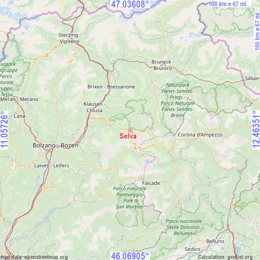
46° 33' 16.992" North, 11° 45' 37.368" East
| Map corner | latitude | longitude |
|---|---|---|
| Upper-left | 47.03608°, | 11.05726° |
| Center: | 46.55472°, | 11.76038° |
| Lower-right: | 46.06905°, | 12.46351° |
| Map W x H: | 107.5×107.5 km | = 66.8×66.8mi |
| max Lat: | 47.04031° ⇑1.3% North |
| Selva: | 46.55472° |
| min Lat: | ⇓98.7% South 35.50142° |
| min Long | Selva | max Long |
| 6.69888° | 11.76038° | 18.48682° |
| W 52.6%⇐ | ⇒47.4% E |
Elevation
Elevation of Selva is 1567 m = 5141 ft, and this is 1260.3 m = 4135 ft above average elevation for this country.
| Max E: |
2085 m = 6841 ft | 0.2% |
| Selva | 1567 m 5141 ft | |
| Avg. | 306.7 m = 1006 ft | |
Min E: |
-4 m = -13 ft | 99.8% |
See also: Italy elevation on elevation.city.
Geographical zone
Selva is located in North temperate zone (between Tropic of Cancer and the Arctic Circle). Distance of this North polar circle is 2224.8 km =1382.4 mi to North.| Distance of | km | miles | from Selva |
|---|---|---|---|
| North Pole | 4830.7 | 3001.7 | to North |
| Arctic Circle | 2224.8 | 1382.4 | to North |
| Tropic Cancer | 2570.5 | 1597.2 | to South |
| Equator | 5176.4 | 3216.5 | to South |


Nearby cities:
15 places around Selva: (largest is in red/bold)
• Alba-Penia
11.1 km =6.9 mi,  165°
165°
• Badia
12 km =7.5 mi,  60°
60°
• Campitello di Fassa
8.9 km =5.5 mi,  189°
189°
• Canazei
8.7 km =5.4 mi,  175°
175°
• Castelrotto
15.3 km =9.5 mi,  274°
274°
• Corvara in Badia
8.7 km =5.4 mi,  93°
93°
• Funes - Villnoess
11.6 km =7.2 mi,  327°
327°
• La Villa
11.6 km =7.2 mi,  72°
72°
• Mazzin
11.8 km =7.3 mi,  203°
203°
• Ortisei
7.2 km =4.5 mi,  289°
289°
• Pera
13.6 km =8.5 mi, 202°
• Pozza di Fassa
15.2 km =9.4 mi, 201°
• San Pietro
11.3 km =7 mi, 328°
• Santa Cristina Valgardena
2.3 km =1.4 mi, 293°
• Siusi
15.5 km =9.6 mi,  264°
264°
In other languages:
- In France: Selva di Val Gardena
- In German: Wolkenstein, Wolkenstein in Gröden
- In Italian: Selva di Val Gardena
Sources, notices
• [Note1] Compared only with cities in Italy existing in our database
• [Src1] Map data: © OpenStreetMap contributors (CC-BY-SA)
• [Src2] Other city data from geonames.org with taken over terms of usage.
• [Src3] Geographical zone / Annual Mean Temperature by Robert A. Rohde @ Wikipedia
