Pera geodata
Pera (Trentino-Alto Adige) is a populated place; located in Italy in Europe/Rome (GMT+2) time zone. With population of 504 people, there are 9889 cities with bigger population in this country. Compared to other cities in Italy, 98% of cities are located further ↓South; 51.7% of cities are located further ←West and 99.3% of cities have lower elevation than Pera. Note1
Administrative division(s):
- Level 1: Trentino-Alto Adige
- Level 2: Provincia autonoma di Trento
- Level 3: Sèn Jan di Fassa


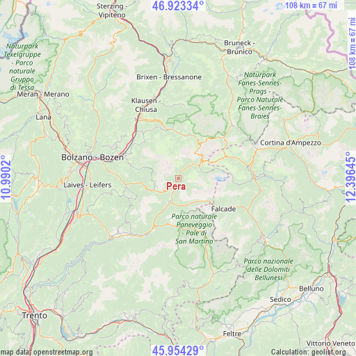
Pera GPS coordinates[2]
46° 26' 27.492" North, 11° 41' 35.952" East
| Map corner | latitude | longitude |
|---|---|---|
| Upper-left | 46.92334°, | 10.9902° |
| Center: | 46.44097°, | 11.69332° |
| Lower-right: | 45.95429°, | 12.39645° |
| Map W x H: | 107.7×107.7 km | = 66.9×66.9mi |
| max Lat: | 47.04031° ⇑2% North |
| Pera: | 46.44097° |
| min Lat: | ⇓98% South 35.50142° |
| min Long | Pera | max Long |
| 6.69888° | 11.69332° | 18.48682° |
| W 51.7%⇐ | ⇒48.3% E |
Elevation
Elevation of Pera is 1343 m = 4406 ft, and this is 1036.3 m = 3400 ft above average elevation for this country.
| Max E: |
2085 m = 6841 ft | 0.7% |
| Pera | 1343 m 4406 ft | |
| Avg. | 306.7 m = 1006 ft | |
Min E: |
-4 m = -13 ft | 99.3% |
See also: Italy elevation on elevation.city.
Geographical zone
Pera is located in North temperate zone (between Tropic of Cancer and the Arctic Circle). Distance of this North polar circle is 2237.4 km =1390.3 mi to North.| Distance of | km | miles | from Pera |
|---|---|---|---|
| North Pole | 4843.3 | 3009.5 | to North |
| Arctic Circle | 2237.4 | 1390.3 | to North |
| Tropic Cancer | 2557.8 | 1589.3 | to South |
| Equator | 5163.8 | 3208.6 | to South |


Nearby cities:
15 places around Pera: (largest is in red/bold)
• Alba-Penia
8.2 km =5.1 mi,  76°
76°
• Campitello di Fassa
5.3 km =3.3 mi,  43°
43°
• Canazei
7 km =4.3 mi,  55°
55°
• Falcade Alto
15.8 km =9.8 mi,  127°
127°
• Mazzin
1.9 km =1.2 mi,  16°
16°
• Moena
7.6 km =4.7 mi,  199°
199°
• Nova Levante
11.9 km =7.4 mi,  263°
263°
• Ortisei
15.1 km =9.4 mi,  353°
353°
• Pozza di Fassa
1.5 km =0.9 mi, 198°
• Santa Cristina Valgardena
13.9 km =8.6 mi,  12°
12°
• Selva
13.6 km =8.5 mi, 22°
• Siusi
15.2 km =9.4 mi,  317°
317°
• Soraga
5.6 km =3.5 mi, 201°
• Tires
13.1 km =8.1 mi,  283°
283°
• Vigo di Fassa
2.9 km =1.8 mi,  210°
210°
Sources, notices
• [Note1] Compared only with cities in Italy existing in our database
• [Src1] Map data: © OpenStreetMap contributors (CC-BY-SA)
• [Src2] Other city data from geonames.org with taken over terms of usage.
• [Src3] Geographical zone / Annual Mean Temperature by Robert A. Rohde @ Wikipedia
