Vezzano Ligure geodata
Vezzano Ligure (Liguria) is a seat of a third-order administrative division; located in Italy in Europe/Rome (GMT+2) time zone. With population of 1,392 people, there are 5382 cities with bigger population in this country. Compared to other cities in Italy, 53.4% of cities are located further ↑North; 68.9% of cities are located further →East and 52.5% of cities have higher elevation than Vezzano Ligure. Note1
Administrative division(s):
- Level 1: Liguria
- Level 2: Provincia di La Spezia
- Level 3: Vezzano Ligure


Vezzano Ligure GPS coordinates[2]
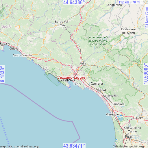
44° 8' 29.184" North, 9° 53' 12.912" East
| Map corner | latitude | longitude |
|---|---|---|
| Upper-left | 44.64386°, | 9.1838° |
| Center: | 44.14144°, | 9.88692° |
| Lower-right: | 43.63471°, | 10.59005° |
| Map W x H: | 112.2×112.2 km | = 69.7×69.7mi |
| max Lat: | 47.04031° ⇑53.4% North |
| Vezzano Ligure: | 44.14144° |
| min Lat: | ⇓46.6% South 35.50142° |
| min Long | Vezzano Ligure | max Long |
| 6.69888° | 9.88692° | 18.48682° |
| W 31.1%⇐ | ⇒68.9% E |
Elevation
Elevation of Vezzano Ligure is 219 m = 719 ft, and this is 87.7 m = 288 ft below average elevation for this country.
| Max E: |
2085 m = 6841 ft | 52.5% |
| Avg. | 306.7 m = 1006 ft | |
| Vezzano Ligure | 219 m = 719 ft | |
Min E: |
-4 m = -13 ft | 47.5% |
See also: Italy elevation on elevation.city.
Geographical zone
Vezzano Ligure is located in North temperate zone (between Tropic of Cancer and the Arctic Circle). Distance of this Northern Tropic circle is 2302.1 km =1430.5 mi to South.| Distance of | km | miles | from Vezzano Ligure |
|---|---|---|---|
| North Pole | 5099 | 3168.4 | to North |
| Arctic Circle | 2493.1 | 1549.1 | to North |
| Tropic Cancer | 2302.1 | 1430.5 | to South |
| Equator | 4908.1 | 3049.8 | to South |


Nearby cities:
15 places around Vezzano Ligure: (largest is in red/bold)
• Albiano Magra
4.5 km =2.8 mi,  31°
31°
• Arcola
3.3 km =2.1 mi,  143°
143°
• Bolano
5.2 km =3.2 mi,  7°
7°
• Ceparana-Carpena
2.8 km =1.7 mi,  354°
354°
• La Spezia
6.6 km =4.1 mi,  229°
229°
• Lerici
7.5 km =4.7 mi,  165°
165°
• Piana Battolla
6.3 km =3.9 mi,  335°
335°
• Piano di Follo
3.2 km =2 mi,  321°
321°
• Piano di Valeriano-Bottagna
1.5 km =0.9 mi, 316°
• Pitelli
5.2 km =3.2 mi,  181°
181°
• Romito Magra
6 km =3.7 mi, 143°
• San Terenzo
6.3 km =3.9 mi, 172°
• Santo Stefano di Magra
2.9 km =1.8 mi,  73°
73°
• Sarzana
6.9 km =4.3 mi,  118°
118°
• Stazione-Fornola
1.3 km =0.8 mi,  163°
163°
Sources, notices
• [Note1] Compared only with cities in Italy existing in our database
• [Src1] Map data: © OpenStreetMap contributors (CC-BY-SA)
• [Src2] Other city data from geonames.org with taken over terms of usage.
• [Src3] Geographical zone / Annual Mean Temperature by Robert A. Rohde @ Wikipedia
