Lerici geodata
Lerici (Liguria) is a seat of a third-order administrative division; located in Italy in Europe/Rome (GMT+2) time zone. With population of 8,793 people, there are 1081 cities with bigger population in this country. Compared to other cities in Italy, 53.9% of cities are located further ↑North; 68.7% of cities are located further →East and 93% of cities have higher elevation than Lerici. Note1


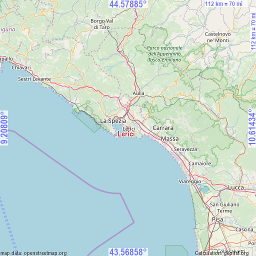
Lerici GPS coordinates[2]
44° 4' 33.132" North, 9° 54' 40.356" East
| Map corner | latitude | longitude |
|---|---|---|
| Upper-left | 44.57885°, | 9.20809° |
| Center: | 44.07587°, | 9.91121° |
| Lower-right: | 43.56858°, | 10.61434° |
| Map W x H: | 112.3×112.3 km | = 69.8×69.8mi |
| max Lat: | 47.04031° ⇑53.9% North |
| Lerici: | 44.07587° |
| min Lat: | ⇓46.1% South 35.50142° |
| min Long | Lerici | max Long |
| 6.69888° | 9.91121° | 18.48682° |
| W 31.3%⇐ | ⇒68.7% E |
Elevation
Elevation of Lerici is 12 m = 39 ft, and this is 294.7 m = 967 ft below average elevation for this country.
| Max E: |
2085 m = 6841 ft | 93% |
| Avg. | 306.7 m = 1006 ft | |
| Lerici | 12 m = 39 ft | |
Min E: |
-4 m = -13 ft | 7% |
See also: Italy elevation on elevation.city.
Geographical zone
Lerici is located in North temperate zone (between Tropic of Cancer and the Arctic Circle). Distance of this Northern Tropic circle is 2294.9 km =1426 mi to South.| Distance of | km | miles | from Lerici |
|---|---|---|---|
| North Pole | 5106.3 | 3172.9 | to North |
| Arctic Circle | 2500.4 | 1553.7 | to North |
| Tropic Cancer | 2294.9 | 1426 | to South |
| Equator | 4900.8 | 3045.2 | to South |


Nearby cities:
15 places around Lerici: (largest is in red/bold)
• Ameglia
4.4 km =2.7 mi,  97°
97°
• Arcola
4.7 km =2.9 mi,  0°
0°
• Borghetto-Melara
6.8 km =4.2 mi,  68°
68°
• Fezzano
6.8 km =4.2 mi,  274°
274°
• Fiumaretta di Ameglia
6.8 km =4.2 mi,  112°
112°
• Le Grazie
6.3 km =3.9 mi,  260°
260°
• Luni Mare
7.6 km =4.7 mi, 104°
• Pitelli
3 km =1.9 mi,  314°
314°
• Portovenere
6.7 km =4.2 mi,  245°
245°
• Romito Magra
3 km =1.9 mi,  33°
33°
• San Terenzo
1.6 km =1 mi, 312°
• Sarzana
5.7 km =3.5 mi,  45°
45°
• Stazione-Fornola
6.2 km =3.9 mi,  345°
345°
• Tellaro
2 km =1.2 mi,  139°
139°
• Vezzano Ligure
7.5 km =4.7 mi, 345°
Sources, notices
• [Note1] Compared only with cities in Italy existing in our database
• [Src1] Map data: © OpenStreetMap contributors (CC-BY-SA)
• [Src2] Other city data from geonames.org with taken over terms of usage.
• [Src3] Geographical zone / Annual Mean Temperature by Robert A. Rohde @ Wikipedia
