Bolano geodata
Bolano (Liguria) is a seat of a third-order administrative division; located in Italy in Europe/Rome (GMT+2) time zone. With population of 712 people, there are 8214 cities with bigger population in this country. Compared to other cities in Italy, 52.9% of cities are located further ↑North; 68.9% of cities are located further →East and 63.1% of cities have lower elevation than Bolano. Note1


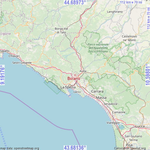
Bolano GPS coordinates[2]
44° 11' 15.72" North, 9° 53' 41.568" East
| Map corner | latitude | longitude |
|---|---|---|
| Upper-left | 44.68973°, | 9.19176° |
| Center: | 44.1877°, | 9.89488° |
| Lower-right: | 43.68136°, | 10.59801° |
| Map W x H: | 112.1×112.1 km | = 69.7×69.7mi |
| max Lat: | 47.04031° ⇑52.9% North |
| Bolano: | 44.1877° |
| min Lat: | ⇓47.1% South 35.50142° |
| min Long | Bolano | max Long |
| 6.69888° | 9.89488° | 18.48682° |
| W 31.1%⇐ | ⇒68.9% E |
Elevation
Elevation of Bolano is 324 m = 1063 ft, and this is 17.3 m = 57 ft above average elevation for this country.
| Max E: |
2085 m = 6841 ft | 36.9% |
| Bolano | 324 m 1063 ft | |
| Avg. | 306.7 m = 1006 ft | |
Min E: |
-4 m = -13 ft | 63.1% |
See also: Italy elevation on elevation.city.
Geographical zone
Bolano is located in North temperate zone (between Tropic of Cancer and the Arctic Circle). Distance of this Northern Tropic circle is 2307.3 km =1433.7 mi to South.| Distance of | km | miles | from Bolano |
|---|---|---|---|
| North Pole | 5093.9 | 3165.2 | to North |
| Arctic Circle | 2488 | 1546 | to North |
| Tropic Cancer | 2307.3 | 1433.7 | to South |
| Equator | 4913.2 | 3052.9 | to South |


Nearby cities:
15 places around Bolano: (largest is in red/bold)
• Albiano Magra
2.2 km =1.4 mi,  128°
128°
• Aulla
7 km =4.3 mi,  72°
72°
• Barbarasco
7.2 km =4.5 mi,  34°
34°
• Ceparana-Carpena
2.5 km =1.6 mi,  201°
201°
• Masero
7.4 km =4.6 mi,  53°
53°
• Montale
4.5 km =2.8 mi,  62°
62°
• Piana Battolla
3.4 km =2.1 mi,  280°
280°
• Piano di Follo
3.7 km =2.3 mi,  224°
224°
• Piano di Valeriano-Bottagna
4.4 km =2.7 mi, 202°
• Podenzana
4.3 km =2.7 mi, 61°
• Santo Stefano di Magra
4.8 km =3 mi,  153°
153°
• Stazione-Fornola
6.4 km =4 mi,  182°
182°
• Terrarossa
7.3 km =4.5 mi, 45°
• Tresana
7.5 km =4.7 mi,  10°
10°
• Vezzano Ligure
5.2 km =3.2 mi,  187°
187°
Sources, notices
• [Note1] Compared only with cities in Italy existing in our database
• [Src1] Map data: © OpenStreetMap contributors (CC-BY-SA)
• [Src2] Other city data from geonames.org with taken over terms of usage.
• [Src3] Geographical zone / Annual Mean Temperature by Robert A. Rohde @ Wikipedia
