Stazione-Fornola geodata
Stazione-Fornola (Liguria) is a populated place; located in Italy in Europe/Rome (GMT+2) time zone. With population of 2,990 people, there are 3051 cities with bigger population in this country. Compared to other cities in Italy, 53.4% of cities are located further ↑North; 68.9% of cities are located further →East and 82.5% of cities have higher elevation than Stazione-Fornola. Note1
Administrative division(s):
- Level 1: Liguria
- Level 2: Provincia di La Spezia
- Level 3: Vezzano Ligure


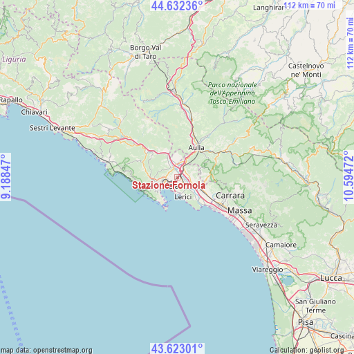
Stazione-Fornola GPS coordinates[2]
44° 7' 47.424" North, 9° 53' 29.724" East
| Map corner | latitude | longitude |
|---|---|---|
| Upper-left | 44.63236°, | 9.18847° |
| Center: | 44.12984°, | 9.89159° |
| Lower-right: | 43.62301°, | 10.59472° |
| Map W x H: | 112.2×112.2 km | = 69.7×69.7mi |
| max Lat: | 47.04031° ⇑53.4% North |
| Stazione-Fornola: | 44.12984° |
| min Lat: | ⇓46.6% South 35.50142° |
| min Long | Stazione-Fornol | max Long |
| 6.69888° | 9.89159° | 18.48682° |
| W 31.1%⇐ | ⇒68.9% E |
Elevation
Elevation of Stazione-Fornola is 40 m = 131 ft, and this is 266.7 m = 875 ft below average elevation for this country.
| Max E: |
2085 m = 6841 ft | 82.5% |
| Avg. | 306.7 m = 1006 ft | |
| Stazione-Fornola | 40 m = 131 ft | |
Min E: |
-4 m = -13 ft | 17.5% |
See also: Italy elevation on elevation.city.
Geographical zone
Stazione-Fornola is located in North temperate zone (between Tropic of Cancer and the Arctic Circle). Distance of this Northern Tropic circle is 2300.9 km =1429.7 mi to South.| Distance of | km | miles | from Stazione-Fornola |
|---|---|---|---|
| North Pole | 5100.3 | 3169.2 | to North |
| Arctic Circle | 2494.4 | 1549.9 | to North |
| Tropic Cancer | 2300.9 | 1429.7 | to South |
| Equator | 4906.8 | 3048.9 | to South |


Nearby cities:
15 places around Stazione-Fornola: (largest is in red/bold)
• Albiano Magra
5.5 km =3.4 mi,  21°
21°
• Arcola
2.1 km =1.3 mi,  129°
129°
• Bolano
6.4 km =4 mi,  2°
2°
• Ceparana-Carpena
4.1 km =2.5 mi,  350°
350°
• Fezzano
7.6 km =4.7 mi,  223°
223°
• La Spezia
6.2 km =3.9 mi,  241°
241°
• Lerici
6.2 km =3.9 mi,  165°
165°
• Piano di Follo
4.5 km =2.8 mi,  327°
327°
• Piano di Valeriano-Bottagna
2.8 km =1.7 mi, 329°
• Pitelli
4 km =2.5 mi,  187°
187°
• Romito Magra
4.7 km =2.9 mi,  137°
137°
• San Terenzo
5 km =3.1 mi,  175°
175°
• Santo Stefano di Magra
3.2 km =2 mi,  48°
48°
• Sarzana
6 km =3.7 mi,  109°
109°
• Vezzano Ligure
1.3 km =0.8 mi,  343°
343°
Sources, notices
• [Note1] Compared only with cities in Italy existing in our database
• [Src1] Map data: © OpenStreetMap contributors (CC-BY-SA)
• [Src2] Other city data from geonames.org with taken over terms of usage.
• [Src3] Geographical zone / Annual Mean Temperature by Robert A. Rohde @ Wikipedia
