Piano di Valeriano-Bottagna geodata
Piano di Valeriano-Bottagna (Liguria) is a populated place; located in Italy in Europe/Rome (GMT+2) time zone. With population of 916 people, there are 7056 cities with bigger population in this country. Compared to other cities in Italy, 53.3% of cities are located further ↑North; 69.1% of cities are located further →East and 84.4% of cities have higher elevation than Piano di Valeriano-Bottagna. Note1
Administrative division(s):
- Level 1: Liguria
- Level 2: Provincia di La Spezia
- Level 3: Vezzano Ligure
Current local time in Piano di Valeriano-Bottagna:
10:51 PM, WednesdayDifference from your time zone: hours


Piano di Valeriano-Bottagna GPS coordinates[2]
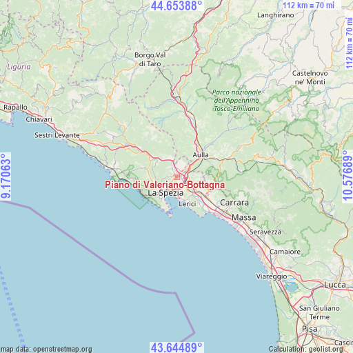
44° 9' 5.544" North, 9° 52' 25.536" East
| Map corner | latitude | longitude |
|---|---|---|
| Upper-left | 44.65388°, | 9.17063° |
| Center: | 44.15154°, | 9.87376° |
| Lower-right: | 43.64489°, | 10.57689° |
| Map W x H: | 112.2×112.2 km | = 69.7×69.7mi |
| max Lat: | 47.04031° ⇑53.3% North |
| Piano di Valeriano-Bottagna: | 44.15154° |
| min Lat: | ⇓46.7% South 35.50142° |
| min Long | Piano di Valeri | max Long |
| 6.69888° | 9.87376° | 18.48682° |
| W 30.9%⇐ | ⇒69.1% E |
Elevation
Elevation of Piano di Valeriano-Bottagna is 33 m = 108 ft, and this is 273.7 m = 898 ft below average elevation for this country.
| Max E: |
2085 m = 6841 ft | 84.4% |
| Avg. | 306.7 m = 1006 ft | |
| Piano di Valeriano-Bottagna | 33 m = 108 ft | |
Min E: |
-4 m = -13 ft | 15.6% |
See also: Italy elevation on elevation.city.
Geographical zone
Piano di Valeriano-Bottagna is located in North temperate zone (between Tropic of Cancer and the Arctic Circle). Distance of this Northern Tropic circle is 2303.3 km =1431.2 mi to South.| Distance of | km | miles | from Piano di Valeriano-Bottagna |
|---|---|---|---|
| North Pole | 5097.9 | 3167.7 | to North |
| Arctic Circle | 2492 | 1548.5 | to North |
| Tropic Cancer | 2303.3 | 1431.2 | to South |
| Equator | 4909.2 | 3050.4 | to South |


Nearby cities:
15 places around Piano di Valeriano-Bottagna: (largest is in red/bold)
• Albiano Magra
4.3 km =2.7 mi,  51°
51°
• Arcola
4.8 km =3 mi,  141°
141°
• Bolano
4.4 km =2.7 mi,  22°
22°
• Ceparana-Carpena
1.8 km =1.1 mi, 24°
• La Spezia
6.7 km =4.2 mi,  216°
216°
• Piana Battolla
4.9 km =3 mi,  340°
340°
• Piano di Follo
1.7 km =1.1 mi,  325°
325°
• Pitelli
6.4 km =4 mi,  172°
172°
• Podenzana
8.2 km =5.1 mi,  41°
41°
• Romito Magra
7.5 km =4.7 mi, 141°
• San Benedetto
7.9 km =4.9 mi,  256°
256°
• San Terenzo
7.6 km =4.7 mi, 166°
• Santo Stefano di Magra
3.8 km =2.4 mi,  94°
94°
• Stazione-Fornola
2.8 km =1.7 mi,  149°
149°
• Vezzano Ligure
1.5 km =0.9 mi, 136°
Sources, notices
• [Note1] Compared only with cities in Italy existing in our database
• [Src1] Map data: © OpenStreetMap contributors (CC-BY-SA)
• [Src2] Other city data from geonames.org with taken over terms of usage.
• [Src3] Geographical zone / Annual Mean Temperature by Robert A. Rohde @ Wikipedia
