Lainate geodata
Lainate (Lombardy) is a seat of a third-order administrative division; located in Italy in Europe/Rome (GMT+2) time zone. With population of 25,011 people, there are 325 cities with bigger population in this country. Compared to other cities in Italy, 75.9% of cities are located further ↓South; 80.9% of cities are located further →East and 57.7% of cities have higher elevation than Lainate. Note1
Administrative division(s):
- Level 1: Lombardy
- Level 2: Città metropolitana di Milano
- Level 3: Lainate


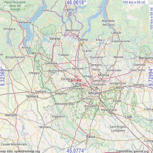
Lainate GPS coordinates[2]
45° 34' 18.336" North, 9° 1' 36.516" East
| Map corner | latitude | longitude |
|---|---|---|
| Upper-left | 46.0618°, | 8.32369° |
| Center: | 45.57176°, | 9.02681° |
| Lower-right: | 45.0774°, | 9.72994° |
| Map W x H: | 109.5×109.5 km | = 68×68mi |
| max Lat: | 47.04031° ⇑24.1% North |
| Lainate: | 45.57176° |
| min Lat: | ⇓75.9% South 35.50142° |
| min Long | Lainate | max Long |
| 6.69888° | 9.02681° | 18.48682° |
| W 19.1%⇐ | ⇒80.9% E |
Elevation
Elevation of Lainate is 182 m = 597 ft, and this is 124.7 m = 409 ft below average elevation for this country.
| Max E: |
2085 m = 6841 ft | 57.7% |
| Avg. | 306.7 m = 1006 ft | |
| Lainate | 182 m = 597 ft | |
Min E: |
-4 m = -13 ft | 42.3% |
See also: Italy elevation on elevation.city.
Geographical zone
Lainate is located in North temperate zone (between Tropic of Cancer and the Arctic Circle). Distance of this North polar circle is 2334.1 km =1450.3 mi to North.| Distance of | km | miles | from Lainate |
|---|---|---|---|
| North Pole | 4940 | 3069.6 | to North |
| Arctic Circle | 2334.1 | 1450.3 | to North |
| Tropic Cancer | 2461.2 | 1529.3 | to South |
| Equator | 5067.1 | 3148.5 | to South |


Nearby cities:
15 places around Lainate: (largest is in red/bold)
• Arese
4.6 km =2.9 mi,  120°
120°
• Cantalupo
3.5 km =2.2 mi,  281°
281°
• Caronno Pertusella
3.3 km =2.1 mi,  27°
27°
• Cerro Maggiore
6.1 km =3.8 mi,  293°
293°
• Cesate
4.7 km =2.9 mi,  54°
54°
• Garbagnate Milanese
3.8 km =2.4 mi,  85°
85°
• Nerviano
4.2 km =2.6 mi,  241°
241°
• Origgio
2.9 km =1.8 mi,  343°
343°
• Passirana
3 km =1.9 mi,  153°
153°
• Pogliano Milanese
4.6 km =2.9 mi,  214°
214°
• Rho
4.5 km =2.8 mi,  166°
166°
• Saronno
6 km =3.7 mi,  6°
6°
• Solaro
6.4 km =4 mi,  42°
42°
• Uboldo
5.2 km =3.2 mi, 339°
• Vanzago
5.8 km =3.6 mi, 208°
Sources, notices
• [Note1] Compared only with cities in Italy existing in our database
• [Src1] Map data: © OpenStreetMap contributors (CC-BY-SA)
• [Src2] Other city data from geonames.org with taken over terms of usage.
• [Src3] Geographical zone / Annual Mean Temperature by Robert A. Rohde @ Wikipedia
