Troviggiano geodata
Troviggiano (The Marches) is a populated place; located in Italy in Europe/Rome (GMT+2) time zone. With population of 1,085 people, there are 6350 cities with bigger population in this country. Compared to other cities in Italy, 60.6% of cities are located further ↑North; 70.9% of cities are located further ←West and 52.8% of cities have lower elevation than Troviggiano. Note1


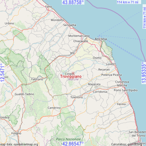
Troviggiano GPS coordinates[2]
43° 22' 43.248" North, 13° 15' 0.792" East
| Map corner | latitude | longitude |
|---|---|---|
| Upper-left | 43.88758°, | 12.5471° |
| Center: | 43.37868°, | 13.25022° |
| Lower-right: | 42.86547°, | 13.95335° |
| Map W x H: | 113.6×113.6 km | = 70.6×70.6mi |
| max Lat: | 47.04031° ⇑60.6% North |
| Troviggiano: | 43.37868° |
| min Lat: | ⇓39.4% South 35.50142° |
| min Long | Troviggiano | max Long |
| 6.69888° | 13.25022° | 18.48682° |
| W 70.9%⇐ | ⇒29.1% E |
Elevation
Elevation of Troviggiano is 252 m = 827 ft, and this is 54.7 m = 179 ft below average elevation for this country.
| Max E: |
2085 m = 6841 ft | 47.2% |
| Avg. | 306.7 m = 1006 ft | |
| Troviggiano | 252 m = 827 ft | |
Min E: |
-4 m = -13 ft | 52.8% |
See also: Italy elevation on elevation.city.
Geographical zone
Troviggiano is located in North temperate zone (between Tropic of Cancer and the Arctic Circle). Distance of this Northern Tropic circle is 2217.3 km =1377.8 mi to South.| Distance of | km | miles | from Troviggiano |
|---|---|---|---|
| North Pole | 5183.8 | 3221.1 | to North |
| Arctic Circle | 2577.9 | 1601.8 | to North |
| Tropic Cancer | 2217.3 | 1377.8 | to South |
| Equator | 4823.3 | 2997.1 | to South |


Nearby cities:
15 places around Troviggiano: (largest is in red/bold)
• Apiro
9.8 km =6.1 mi,  279°
279°
• Appignano
8.1 km =5 mi,  102°
102°
• Cesolo
13.9 km =8.6 mi,  199°
199°
• Chiesanuova
7.6 km =4.7 mi,  126°
126°
• Cingoli
3.4 km =2.1 mi,  264°
264°
• Cupramontana
13.6 km =8.5 mi,  305°
305°
• Filottrano
10.3 km =6.4 mi,  52°
52°
• Grottaccia
4.1 km =2.5 mi,  153°
153°
• Passo di Treia
12.2 km =7.6 mi, 147°
• Poggio San Vicino
13.8 km =8.6 mi,  268°
268°
• San Paolo di Jesi
10.5 km =6.5 mi,  323°
323°
• Santa Maria Nuova
13.9 km =8.6 mi,  25°
25°
• Staffolo
8 km =5 mi, 318°
• Strada
3.6 km =2.2 mi, 319°
• Treia
9.2 km =5.7 mi, 148°
Sources, notices
• [Note1] Compared only with cities in Italy existing in our database
• [Src1] Map data: © OpenStreetMap contributors (CC-BY-SA)
• [Src2] Other city data from geonames.org with taken over terms of usage.
• [Src3] Geographical zone / Annual Mean Temperature by Robert A. Rohde @ Wikipedia
