Orzano geodata
Orzano (Friuli Venezia Giulia) is a populated place; located in Italy in Europe/Rome (GMT+2) time zone. With population of 585 people, there are 9134 cities with bigger population in this country. Compared to other cities in Italy, 93.3% of cities are located further ↓South; 71.9% of cities are located further ←West and 69.2% of cities have higher elevation than Orzano. Note1
Administrative division(s):
- Level 1: Friuli Venezia Giulia
- Level 2: Provincia di Udine
- Level 3: Remanzacco


Orzano GPS coordinates[2]
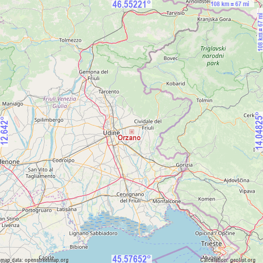
46° 3' 59.472" North, 13° 20' 42.432" East
| Map corner | latitude | longitude |
|---|---|---|
| Upper-left | 46.55221°, | 12.642° |
| Center: | 46.06652°, | 13.34512° |
| Lower-right: | 45.57652°, | 14.04825° |
| Map W x H: | 108.5×108.5 km | = 67.4×67.4mi |
| max Lat: | 47.04031° ⇑6.7% North |
| Orzano: | 46.06652° |
| min Lat: | ⇓93.3% South 35.50142° |
| min Long | Orzano | max Long |
| 6.69888° | 13.34512° | 18.48682° |
| W 71.9%⇐ | ⇒28.1% E |
Elevation
Elevation of Orzano is 102 m = 335 ft, and this is 204.7 m = 672 ft below average elevation for this country.
| Max E: |
2085 m = 6841 ft | 69.2% |
| Avg. | 306.7 m = 1006 ft | |
| Orzano | 102 m = 335 ft | |
Min E: |
-4 m = -13 ft | 30.8% |
See also: Italy elevation on elevation.city.
Geographical zone
Orzano is located in North temperate zone (between Tropic of Cancer and the Arctic Circle). Distance of this North polar circle is 2279.1 km =1416.2 mi to North.| Distance of | km | miles | from Orzano |
|---|---|---|---|
| North Pole | 4884.9 | 3035.3 | to North |
| Arctic Circle | 2279.1 | 1416.2 | to North |
| Tropic Cancer | 2516.2 | 1563.5 | to South |
| Equator | 5122.1 | 3182.7 | to South |


Nearby cities:
15 places around Orzano: (largest is in red/bold)
• Buttrio
6.2 km =3.9 mi,  188°
188°
• Campeglio
7.2 km =4.5 mi,  10°
10°
• Cerneglons
3.2 km =2 mi,  240°
240°
• Cividale del Friuli
7 km =4.3 mi,  67°
67°
• Ipplis
5.6 km =3.5 mi,  117°
117°
• Manzano
9 km =5.6 mi,  164°
164°
• Moimacco
3.5 km =2.2 mi,  37°
37°
• Orsaria
4.2 km =2.6 mi,  137°
137°
• Pavia di Udine
8.6 km =5.3 mi,  201°
201°
• Povoletto
6.8 km =4.2 mi,  323°
323°
• Pradamano
4.9 km =3 mi,  222°
222°
• Premariacco
3.9 km =2.4 mi,  98°
98°
• Remanzacco
2.7 km =1.7 mi, 321°
• Udine
8.3 km =5.2 mi,  272°
272°
• Ziracco
5.1 km =3.2 mi,  358°
358°
Sources, notices
• [Note1] Compared only with cities in Italy existing in our database
• [Src1] Map data: © OpenStreetMap contributors (CC-BY-SA)
• [Src2] Other city data from geonames.org with taken over terms of usage.
• [Src3] Geographical zone / Annual Mean Temperature by Robert A. Rohde @ Wikipedia
