Teglio Veneto geodata
Teglio Veneto (Veneto) is a seat of a third-order administrative division; located in Italy in Europe/Rome (GMT+2) time zone. With population of 1,678 people, there are 4717 cities with bigger population in this country. Compared to other cities in Italy, 86.5% of cities are located further ↓South; 67.1% of cities are located further ←West and 93.6% of cities have higher elevation than Teglio Veneto. Note1


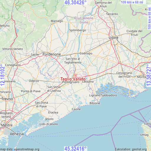
Teglio Veneto GPS coordinates[2]
45° 48' 58.932" North, 12° 53' 2.904" East
| Map corner | latitude | longitude |
|---|---|---|
| Upper-left | 46.30426°, | 12.18102° |
| Center: | 45.81637°, | 12.88414° |
| Lower-right: | 45.32416°, | 13.58727° |
| Map W x H: | 109×109 km | = 67.7×67.7mi |
| max Lat: | 47.04031° ⇑13.5% North |
| Teglio Veneto: | 45.81637° |
| min Lat: | ⇓86.5% South 35.50142° |
| min Long | Teglio Veneto | max Long |
| 6.69888° | 12.88414° | 18.48682° |
| W 67.1%⇐ | ⇒32.9% E |
Elevation
Elevation of Teglio Veneto is 11 m = 36 ft, and this is 295.7 m = 970 ft below average elevation for this country.
| Max E: |
2085 m = 6841 ft | 93.6% |
| Avg. | 306.7 m = 1006 ft | |
| Teglio Veneto | 11 m = 36 ft | |
Min E: |
-4 m = -13 ft | 6.4% |
See also: Italy elevation on elevation.city.
Geographical zone
Teglio Veneto is located in North temperate zone (between Tropic of Cancer and the Arctic Circle). Distance of this North polar circle is 2306.9 km =1433.4 mi to North.| Distance of | km | miles | from Teglio Veneto |
|---|---|---|---|
| North Pole | 4912.8 | 3052.7 | to North |
| Arctic Circle | 2306.9 | 1433.4 | to North |
| Tropic Cancer | 2488.4 | 1546.2 | to South |
| Equator | 5094.3 | 3165.5 | to South |


Nearby cities:
15 places around Teglio Veneto: (largest is in red/bold)
• Bagnarola
5.9 km =3.7 mi,  340°
340°
• Casette
4.2 km =2.6 mi,  355°
355°
• Cintello
1.6 km =1 mi,  275°
275°
• Cordovado
3.1 km =1.9 mi,  1°
1°
• Fossalta di Portogruaro
3.3 km =2.1 mi,  142°
142°
• Giai
5 km =3.1 mi,  266°
266°
• Gruaro
3.9 km =2.4 mi,  301°
301°
• Gruaro-Bagnara
3.8 km =2.4 mi,  317°
317°
• Morsano
5.9 km =3.7 mi,  35°
35°
• Portogruaro
5.2 km =3.2 mi,  220°
220°
• Ramuscello
7.2 km =4.5 mi, 0°
• San Giorgio al Tagliamento-Pozzi
6.5 km =4 mi,  109°
109°
• Sesto al Reghena
6.6 km =4.1 mi, 303°
• Stiago
4.5 km =2.8 mi,  174°
174°
• Villanova Santa Margherita
5.5 km =3.4 mi, 171°
Sources, notices
• [Note1] Compared only with cities in Italy existing in our database
• [Src1] Map data: © OpenStreetMap contributors (CC-BY-SA)
• [Src2] Other city data from geonames.org with taken over terms of usage.
• [Src3] Geographical zone / Annual Mean Temperature by Robert A. Rohde @ Wikipedia
