San Giorgio al Tagliamento-Pozzi geodata
San Giorgio al Tagliamento-Pozzi (Veneto) is a populated place; located in Italy in Europe/Rome (GMT+2) time zone. With population of 1,782 people, there are 4514 cities with bigger population in this country. Compared to other cities in Italy, 85.6% of cities are located further ↓South; 67.9% of cities are located further ←West and 96.6% of cities have higher elevation than San Giorgio al Tagliamento-Pozzi. Note1
Administrative division(s):
- Level 1: Veneto
- Level 2: Provincia di Venezia
- Level 3: San Michele al Tagliamento
Current local time in San Giorgio al Tagliamento-Pozzi:
01:33 AM, ThursdayDifference from your time zone: hours


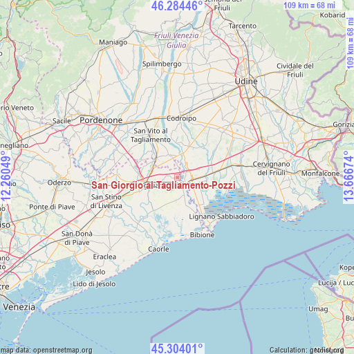
San Giorgio al Tagliamento-Pozzi GPS coordinates[2]
45° 47' 47.004" North, 12° 57' 48.996" East
| Map corner | latitude | longitude |
|---|---|---|
| Upper-left | 46.28446°, | 12.26049° |
| Center: | 45.79639°, | 12.96361° |
| Lower-right: | 45.30401°, | 13.66674° |
| Map W x H: | 109×109 km | = 67.7×67.7mi |
| max Lat: | 47.04031° ⇑14.4% North |
| San Giorgio al Tagliamento-Pozzi: | 45.79639° |
| min Lat: | ⇓85.6% South 35.50142° |
| min Long | San Giorgio al | max Long |
| 6.69888° | 12.96361° | 18.48682° |
| W 67.9%⇐ | ⇒32.1% E |
Elevation
Elevation of San Giorgio al Tagliamento-Pozzi is 6 m = 20 ft, and this is 300.7 m = 987 ft below average elevation for this country.
| Max E: |
2085 m = 6841 ft | 96.6% |
| Avg. | 306.7 m = 1006 ft | |
| San Giorgio al Tagliamento-Pozzi | 6 m = 20 ft | |
Min E: |
-4 m = -13 ft | 3.4% |
See also: Italy elevation on elevation.city.
Geographical zone
San Giorgio al Tagliamento-Pozzi is located in North temperate zone (between Tropic of Cancer and the Arctic Circle). Distance of this North polar circle is 2309.1 km =1434.8 mi to North.| Distance of | km | miles | from San Giorgio al Tagliamento-Pozzi |
|---|---|---|---|
| North Pole | 4915 | 3054 | to North |
| Arctic Circle | 2309.1 | 1434.8 | to North |
| Tropic Cancer | 2486.2 | 1544.9 | to South |
| Equator | 5092.1 | 3164.1 | to South |


Nearby cities:
15 places around San Giorgio al Tagliamento-Pozzi: (largest is in red/bold)
• Casette
9.1 km =5.7 mi,  314°
314°
• Cintello
8.1 km =5 mi,  287°
287°
• Cordovado
8.1 km =5 mi, 311°
• Fossalta di Portogruaro
4.2 km =2.6 mi,  265°
265°
• Gorgo
7.2 km =4.5 mi,  139°
139°
• Latisana
4.5 km =2.8 mi,  133°
133°
• Lugugnana
7.1 km =4.4 mi,  182°
182°
• Morsano
7.6 km =4.7 mi,  338°
338°
• Precenicco
8.7 km =5.4 mi,  89°
89°
• Rivarotta
9.5 km =5.9 mi,  73°
73°
• Ronchis
2.8 km =1.7 mi,  62°
62°
• San Michele al Tagliamento
4.3 km =2.7 mi,  145°
145°
• Stiago
6.2 km =3.9 mi,  248°
248°
• Teglio Veneto
6.5 km =4 mi, 289°
• Villanova Santa Margherita
6.3 km =3.9 mi,  238°
238°
Sources, notices
• [Note1] Compared only with cities in Italy existing in our database
• [Src1] Map data: © OpenStreetMap contributors (CC-BY-SA)
• [Src2] Other city data from geonames.org with taken over terms of usage.
• [Src3] Geographical zone / Annual Mean Temperature by Robert A. Rohde @ Wikipedia
