Stresa geodata
Stresa (Piedmont) is a seat of a third-order administrative division; located in Italy in Europe/Rome (GMT+2) time zone. With population of 3,985 people, there are 2403 cities with bigger population in this country. Compared to other cities in Italy, 88.7% of cities are located further ↓South; 87.5% of cities are located further →East and 52.7% of cities have higher elevation than Stresa. Note1
Administrative division(s):
- Level 1: Piedmont
- Level 2: Provincia Verbano-Cusio-Ossola
- Level 3: Stresa


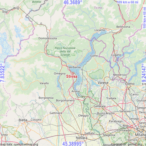
Stresa GPS coordinates[2]
45° 52' 53.688" North, 8° 32' 18.024" East
| Map corner | latitude | longitude |
|---|---|---|
| Upper-left | 46.3689°, | 7.83522° |
| Center: | 45.88158°, | 8.53834° |
| Lower-right: | 45.38995°, | 9.24147° |
| Map W x H: | 108.8×108.8 km | = 67.6×67.6mi |
| max Lat: | 47.04031° ⇑11.3% North |
| Stresa: | 45.88158° |
| min Lat: | ⇓88.7% South 35.50142° |
| min Long | Stresa | max Long |
| 6.69888° | 8.53834° | 18.48682° |
| W 12.5%⇐ | ⇒87.5% E |
Elevation
Elevation of Stresa is 218 m = 715 ft, and this is 88.7 m = 291 ft below average elevation for this country.
| Max E: |
2085 m = 6841 ft | 52.7% |
| Avg. | 306.7 m = 1006 ft | |
| Stresa | 218 m = 715 ft | |
Min E: |
-4 m = -13 ft | 47.3% |
See also: Italy elevation on elevation.city.
Geographical zone
Stresa is located in North temperate zone (between Tropic of Cancer and the Arctic Circle). Distance of this North polar circle is 2299.6 km =1428.9 mi to North.| Distance of | km | miles | from Stresa |
|---|---|---|---|
| North Pole | 4905.5 | 3048.1 | to North |
| Arctic Circle | 2299.6 | 1428.9 | to North |
| Tropic Cancer | 2495.6 | 1550.7 | to South |
| Equator | 5101.6 | 3170 | to South |


Nearby cities:
15 places around Stresa: (largest is in red/bold)
• Baveno
4.2 km =2.6 mi,  315°
315°
• Belgirate
5.1 km =3.2 mi,  150°
150°
• Brovello
4.4 km =2.7 mi,  186°
186°
• Brovello-Carpugnino
4.4 km =2.7 mi, 186°
• Feriolo
7.1 km =4.4 mi, 319°
• Fondotoce
8 km =5 mi,  333°
333°
• Gignese
3 km =1.9 mi,  228°
228°
• Laveno
7 km =4.3 mi,  64°
64°
• Leggiuno
6.4 km =4 mi,  95°
95°
• Lesa
7 km =4.3 mi,  166°
166°
• Massino Visconti
6.4 km =4 mi,  177°
177°
• Monvalle
7.6 km =4.7 mi,  110°
110°
• Pallanza-Intra-Suna
6.7 km =4.2 mi,  21°
21°
• Sangiano
7.4 km =4.6 mi, 95°
• Verbania
4.5 km =2.8 mi,  13°
13°
Sources, notices
• [Note1] Compared only with cities in Italy existing in our database
• [Src1] Map data: © OpenStreetMap contributors (CC-BY-SA)
• [Src2] Other city data from geonames.org with taken over terms of usage.
• [Src3] Geographical zone / Annual Mean Temperature by Robert A. Rohde @ Wikipedia
