Sant'Anna geodata
Sant'Anna (Emilia-Romagna) is a populated place; located in Italy in Europe/Rome (GMT+2) time zone. With population of 870 people, there are 7316 cities with bigger population in this country. Compared to other cities in Italy, 52.5% of cities are located further ↓South; 57.1% of cities are located further →East and 82.2% of cities have higher elevation than Sant'Anna. Note1
Administrative division(s):
- Level 1: Emilia-Romagna
- Level 2: Provincia di Modena
- Level 3: San Cesario sul Panaro


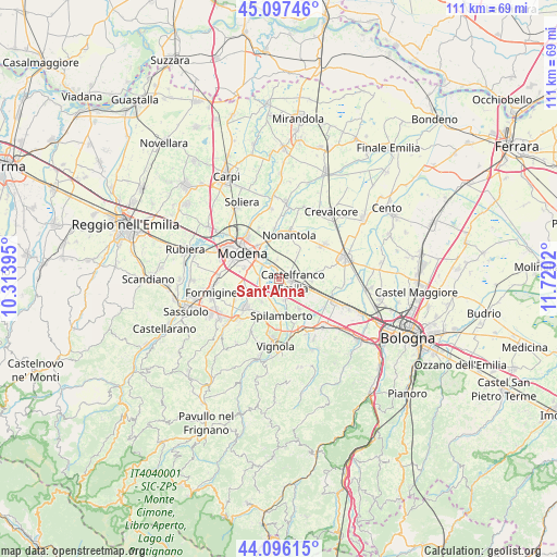
Sant'Anna GPS coordinates[2]
44° 35' 56.256" North, 11° 1' 1.452" East
| Map corner | latitude | longitude |
|---|---|---|
| Upper-left | 45.09746°, | 10.31395° |
| Center: | 44.59896°, | 11.01707° |
| Lower-right: | 44.09615°, | 11.7202° |
| Map W x H: | 111.3×111.3 km | = 69.2×69.2mi |
| max Lat: | 47.04031° ⇑47.5% North |
| Sant'Anna: | 44.59896° |
| min Lat: | ⇓52.5% South 35.50142° |
| min Long | Sant'Anna | max Long |
| 6.69888° | 11.01707° | 18.48682° |
| W 42.9%⇐ | ⇒57.1% E |
Elevation
Elevation of Sant'Anna is 41 m = 135 ft, and this is 265.7 m = 872 ft below average elevation for this country.
| Max E: |
2085 m = 6841 ft | 82.2% |
| Avg. | 306.7 m = 1006 ft | |
| Sant'Anna | 41 m = 135 ft | |
Min E: |
-4 m = -13 ft | 17.8% |
See also: Italy elevation on elevation.city.
Geographical zone
Sant'Anna is located in North temperate zone (between Tropic of Cancer and the Arctic Circle). Distance of this Northern Tropic circle is 2353 km =1462.1 mi to South.| Distance of | km | miles | from Sant'Anna |
|---|---|---|---|
| North Pole | 5048.1 | 3136.7 | to North |
| Arctic Circle | 2442.2 | 1517.5 | to North |
| Tropic Cancer | 2353 | 1462.1 | to South |
| Equator | 4958.9 | 3081.3 | to South |


Nearby cities:
15 places around Sant'Anna: (largest is in red/bold)
• Ca' di Sola
9.1 km =5.7 mi,  212°
212°
• Castelfranco Emilia
2.6 km =1.6 mi,  100°
100°
• Castelnuovo Rangone
8.6 km =5.3 mi,  230°
230°
• Cavazzona
8.6 km =5.3 mi,  109°
109°
• Gaggio
4 km =2.5 mi,  355°
355°
• Manzolino
6.6 km =4.1 mi,  93°
93°
• Modena
9.1 km =5.7 mi,  306°
306°
• Nonantola
8.9 km =5.5 mi,  10°
10°
• Piumazzo
7.1 km =4.4 mi,  145°
145°
• Portile
6.6 km =4.1 mi,  252°
252°
• San Cesario sul Panaro
4.2 km =2.6 mi,  160°
160°
• San Damaso
3.4 km =2.1 mi,  273°
273°
• San Donnino
4.4 km =2.7 mi, 246°
• San Vito
5.7 km =3.5 mi,  216°
216°
• Spilamberto
7.4 km =4.6 mi,  180°
180°
Sources, notices
• [Note1] Compared only with cities in Italy existing in our database
• [Src1] Map data: © OpenStreetMap contributors (CC-BY-SA)
• [Src2] Other city data from geonames.org with taken over terms of usage.
• [Src3] Geographical zone / Annual Mean Temperature by Robert A. Rohde @ Wikipedia
