Manzolino geodata
Manzolino (Emilia-Romagna) is a populated place; located in Italy in Europe/Rome (GMT+2) time zone. With population of 1,569 people, there are 4960 cities with bigger population in this country. Compared to other cities in Italy, 52.4% of cities are located further ↓South; 55.9% of cities are located further →East and 83.1% of cities have higher elevation than Manzolino. Note1
Administrative division(s):
- Level 1: Emilia-Romagna
- Level 2: Provincia di Modena
- Level 3: Castelfranco Emilia


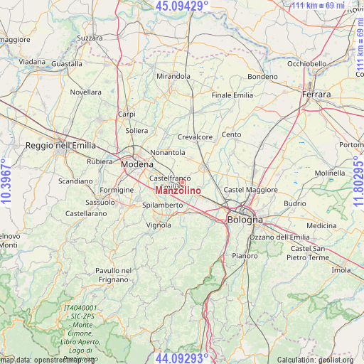
Manzolino GPS coordinates[2]
44° 35' 44.772" North, 11° 5' 59.352" East
| Map corner | latitude | longitude |
|---|---|---|
| Upper-left | 45.09429°, | 10.3967° |
| Center: | 44.59577°, | 11.09982° |
| Lower-right: | 44.09293°, | 11.80295° |
| Map W x H: | 111.3×111.3 km | = 69.2×69.2mi |
| max Lat: | 47.04031° ⇑47.6% North |
| Manzolino: | 44.59577° |
| min Lat: | ⇓52.4% South 35.50142° |
| min Long | Manzolino | max Long |
| 6.69888° | 11.09982° | 18.48682° |
| W 44.1%⇐ | ⇒55.9% E |
Elevation
Elevation of Manzolino is 37 m = 121 ft, and this is 269.7 m = 885 ft below average elevation for this country.
| Max E: |
2085 m = 6841 ft | 83.1% |
| Avg. | 306.7 m = 1006 ft | |
| Manzolino | 37 m = 121 ft | |
Min E: |
-4 m = -13 ft | 16.9% |
See also: Italy elevation on elevation.city.
Geographical zone
Manzolino is located in North temperate zone (between Tropic of Cancer and the Arctic Circle). Distance of this Northern Tropic circle is 2352.7 km =1461.9 mi to South.| Distance of | km | miles | from Manzolino |
|---|---|---|---|
| North Pole | 5048.5 | 3137 | to North |
| Arctic Circle | 2442.6 | 1517.8 | to North |
| Tropic Cancer | 2352.7 | 1461.9 | to South |
| Equator | 4958.6 | 3081.1 | to South |


Nearby cities:
15 places around Manzolino: (largest is in red/bold)
• Budrie
6.5 km =4 mi,  94°
94°
• Calcara
6.1 km =3.8 mi,  153°
153°
• Castelfranco Emilia
4 km =2.5 mi,  267°
267°
• Cavazzona
2.9 km =1.8 mi, 148°
• Crespellano
9.7 km =6 mi,  164°
164°
• Gaggio
8.1 km =5 mi,  302°
302°
• Piumazzo
6.1 km =3.8 mi,  205°
205°
• San Cesario sul Panaro
6.3 km =3.9 mi,  235°
235°
• San Damaso
10 km =6.2 mi, 273°
• San Giacomo del Martignone
9.3 km =5.8 mi, 87°
• San Giovanni in Persiceto
8.2 km =5.1 mi,  54°
54°
• Sant'Agata Bolognese
7.6 km =4.7 mi,  20°
20°
• Sant'Anna
6.6 km =4.1 mi, 273°
• Spilamberto
9.6 km =6 mi,  223°
223°
• Via Larga
8.9 km =5.5 mi,  344°
344°
Sources, notices
• [Note1] Compared only with cities in Italy existing in our database
• [Src1] Map data: © OpenStreetMap contributors (CC-BY-SA)
• [Src2] Other city data from geonames.org with taken over terms of usage.
• [Src3] Geographical zone / Annual Mean Temperature by Robert A. Rohde @ Wikipedia
