Sant'Angelo A Scala geodata
Sant'Angelo A Scala (Campania) is a seat of a third-order administrative division; located in Italy in Europe/Rome (GMT+2) time zone. With population of 566 people, there are 9291 cities with bigger population in this country. Compared to other cities in Italy, 78.9% of cities are located further ↑North; 84.8% of cities are located further ←West and 84% of cities have lower elevation than Sant'Angelo A Scala. Note1
Administrative division(s):
- Level 1: Campania
- Level 2: Provincia di Avellino
- Level 3: Sant'Angelo a Scala


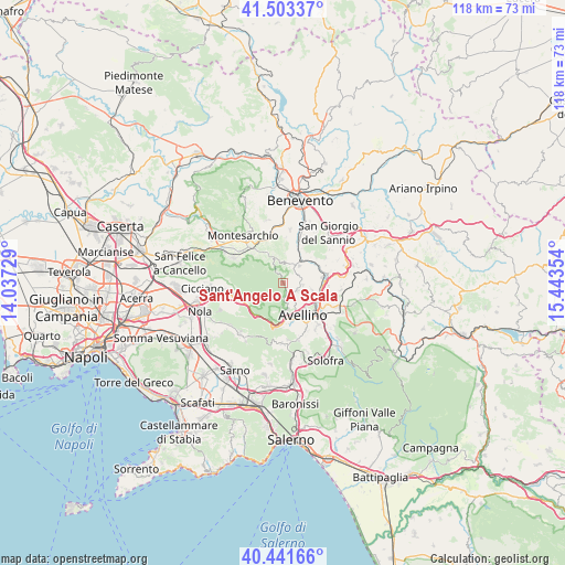
Sant'Angelo A Scala GPS coordinates[2]
40° 58' 28.74" North, 14° 44' 25.476" East
| Map corner | latitude | longitude |
|---|---|---|
| Upper-left | 41.50337°, | 14.03729° |
| Center: | 40.97465°, | 14.74041° |
| Lower-right: | 40.44166°, | 15.44354° |
| Map W x H: | 118.1×118.1 km | = 73.4×73.4mi |
| max Lat: | 47.04031° ⇑78.9% North |
| Sant'Angelo A Scala: | 40.97465° |
| min Lat: | ⇓21.1% South 35.50142° |
| min Long | Sant'Angelo A S | max Long |
| 6.69888° | 14.74041° | 18.48682° |
| W 84.8%⇐ | ⇒15.2% E |
Elevation
Elevation of Sant'Angelo A Scala is 590 m = 1936 ft, and this is 283.3 m = 929 ft above average elevation for this country.
| Max E: |
2085 m = 6841 ft | 16% |
| Sant'Angelo A Scala | 590 m 1936 ft | |
| Avg. | 306.7 m = 1006 ft | |
Min E: |
-4 m = -13 ft | 84% |
See also: Italy elevation on elevation.city.
Geographical zone
Sant'Angelo A Scala is located in North temperate zone (between Tropic of Cancer and the Arctic Circle). Distance of this Northern Tropic circle is 1950 km =1211.7 mi to South.| Distance of | km | miles | from Sant'Angelo A Scala |
|---|---|---|---|
| North Pole | 5451.1 | 3387.2 | to North |
| Arctic Circle | 2845.2 | 1767.9 | to North |
| Tropic Cancer | 1950 | 1211.7 | to South |
| Equator | 4556 | 2831 | to South |


Nearby cities:
15 places around Sant'Angelo A Scala: (largest is in red/bold)
• Altavilla Irpina
4.9 km =3 mi,  44°
44°
• Arpaise
6.1 km =3.8 mi,  2°
2°
• Capriglia
3.6 km =2.2 mi,  117°
117°
• Capriglia Irpina
3.5 km =2.2 mi, 117°
• Cassano
6.6 km =4.1 mi,  340°
340°
• Grottolella
4.1 km =2.5 mi,  95°
95°
• Mercogliano
5.9 km =3.7 mi,  176°
176°
• Montefredane
6.4 km =4 mi,  105°
105°
• Ospedaletto d'Alpinolo
4 km =2.5 mi,  172°
172°
• Pannarano
5.1 km =3.2 mi,  321°
321°
• Pietrastornina
3 km =1.9 mi, 321°
• Roccabascerana
5.3 km =3.3 mi, 337°
• Summonte
2.9 km =1.8 mi, 173°
• Torelli-Torrette
7.5 km =4.7 mi, 172°
• Tufo
7.7 km =4.8 mi,  56°
56°
Sources, notices
• [Note1] Compared only with cities in Italy existing in our database
• [Src1] Map data: © OpenStreetMap contributors (CC-BY-SA)
• [Src2] Other city data from geonames.org with taken over terms of usage.
• [Src3] Geographical zone / Annual Mean Temperature by Robert A. Rohde @ Wikipedia
