Sant'Agata Bolognese geodata
Sant'Agata Bolognese (Emilia-Romagna) is a seat of a third-order administrative division; located in Italy in Europe/Rome (GMT+2) time zone. With population of 5,591 people, there are 1755 cities with bigger population in this country. Compared to other cities in Italy, 53.5% of cities are located further ↓South; 55.4% of cities are located further →East and 88.3% of cities have higher elevation than Sant'Agata Bolognese. Note1
Current local time in Sant'Agata Bolognese:
06:58 PM, WednesdayDifference from your time zone: hours


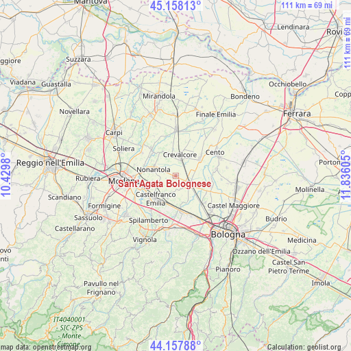
Sant'Agata Bolognese GPS coordinates[2]
44° 39' 36.576" North, 11° 7' 58.512" East
| Map corner | latitude | longitude |
|---|---|---|
| Upper-left | 45.15813°, | 10.4298° |
| Center: | 44.66016°, | 11.13292° |
| Lower-right: | 44.15788°, | 11.83605° |
| Map W x H: | 111.2×111.2 km | = 69.1×69.1mi |
| max Lat: | 47.04031° ⇑46.5% North |
| Sant'Agata Bolognese: | 44.66016° |
| min Lat: | ⇓53.5% South 35.50142° |
| min Long | Sant'Agata Bolo | max Long |
| 6.69888° | 11.13292° | 18.48682° |
| W 44.6%⇐ | ⇒55.4% E |
Elevation
Elevation of Sant'Agata Bolognese is 22 m = 72 ft, and this is 284.7 m = 934 ft below average elevation for this country.
| Max E: |
2085 m = 6841 ft | 88.3% |
| Avg. | 306.7 m = 1006 ft | |
| Sant'Agata Bolognese | 22 m = 72 ft | |
Min E: |
-4 m = -13 ft | 11.7% |
See also: Italy elevation on elevation.city.
Geographical zone
Sant'Agata Bolognese is located in North temperate zone (between Tropic of Cancer and the Arctic Circle). Distance of this Northern Tropic circle is 2359.8 km =1466.3 mi to South.| Distance of | km | miles | from Sant'Agata Bolognese |
|---|---|---|---|
| North Pole | 5041.3 | 3132.5 | to North |
| Arctic Circle | 2435.4 | 1513.3 | to North |
| Tropic Cancer | 2359.8 | 1466.3 | to South |
| Equator | 4965.7 | 3085.5 | to South |


Nearby cities:
15 places around Sant'Agata Bolognese: (largest is in red/bold)
• Bomporto
11.2 km =7 mi,  317°
317°
• Budrie
8.6 km =5.3 mi,  153°
153°
• Castelfranco Emilia
9.8 km =6.1 mi,  221°
221°
• Cavazzona
9.7 km =6 mi,  186°
186°
• Crevalcore
6.7 km =4.2 mi,  9°
9°
• Decima
9.5 km =5.9 mi,  53°
53°
• Gaggio
9.9 km =6.2 mi,  253°
253°
• La Grande
8.4 km =5.2 mi, 319°
• Manzolino
7.6 km =4.7 mi,  200°
200°
• Nonantola
7.8 km =4.8 mi,  284°
284°
• Ravarino
7.8 km =4.8 mi,  337°
337°
• Sala Bolognese
11.1 km =6.9 mi,  117°
117°
• San Giacomo del Martignone
9.4 km =5.8 mi,  135°
135°
• San Giovanni in Persiceto
4.7 km =2.9 mi, 120°
• Via Larga
5.2 km =3.2 mi,  285°
285°
Sources, notices
• [Note1] Compared only with cities in Italy existing in our database
• [Src1] Map data: © OpenStreetMap contributors (CC-BY-SA)
• [Src2] Other city data from geonames.org with taken over terms of usage.
• [Src3] Geographical zone / Annual Mean Temperature by Robert A. Rohde @ Wikipedia
