San Polomatese geodata
San Polomatese (Molise) is a seat of a third-order administrative division; located in Italy in Europe/Rome (GMT+2) time zone. With population of 160 people, there are 11249 cities with bigger population in this country. Compared to other cities in Italy, 75.2% of cities are located further ↑North; 82.6% of cities are located further ←West and 90.6% of cities have lower elevation than San Polomatese. Note1
Administrative division(s):
- Level 1: Molise
- Level 2: Provincia di Campobasso
- Level 3: San Polo Matese


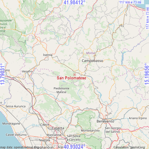
San Polomatese GPS coordinates[2]
41° 27' 33.552" North, 14° 29' 36.348" East
| Map corner | latitude | longitude |
|---|---|---|
| Upper-left | 41.98412°, | 13.79031° |
| Center: | 41.45932°, | 14.49343° |
| Lower-right: | 40.93024°, | 15.19656° |
| Map W x H: | 117.2×117.2 km | = 72.8×72.8mi |
| max Lat: | 47.04031° ⇑75.2% North |
| San Polomatese: | 41.45932° |
| min Lat: | ⇓24.8% South 35.50142° |
| min Long | San Polomatese | max Long |
| 6.69888° | 14.49343° | 18.48682° |
| W 82.6%⇐ | ⇒17.4% E |
Elevation
Elevation of San Polomatese is 734 m = 2408 ft, and this is 427.3 m = 1402 ft above average elevation for this country.
| Max E: |
2085 m = 6841 ft | 9.4% |
| San Polomatese | 734 m 2408 ft | |
| Avg. | 306.7 m = 1006 ft | |
Min E: |
-4 m = -13 ft | 90.6% |
See also: Italy elevation on elevation.city.
Geographical zone
San Polomatese is located in North temperate zone (between Tropic of Cancer and the Arctic Circle). Distance of this Northern Tropic circle is 2003.9 km =1245.2 mi to South.| Distance of | km | miles | from San Polomatese |
|---|---|---|---|
| North Pole | 5397.2 | 3353.7 | to North |
| Arctic Circle | 2791.3 | 1734.4 | to North |
| Tropic Cancer | 2003.9 | 1245.2 | to South |
| Equator | 4609.8 | 2864.4 | to South |


Nearby cities:
15 places around San Polomatese: (largest is in red/bold)
• Baranello
9.3 km =5.8 mi,  35°
35°
• Bojano
3.5 km =2.2 mi,  326°
326°
• Busso
12 km =7.5 mi,  28°
28°
• Campochiaro
1.7 km =1.1 mi,  134°
134°
• Cantalupo nel Sannio
10.9 km =6.8 mi,  309°
309°
• Colle d'Anchise
6 km =3.7 mi,  20°
20°
• Guardiaregia
5 km =3.1 mi,  123°
123°
• Largo Zullo-Sterparo
10.5 km =6.5 mi,  50°
50°
• Monteverde
4.4 km =2.7 mi,  351°
351°
• Roccamandolfi
12.4 km =7.7 mi,  289°
289°
• San Giuliano del Sannio
12.4 km =7.7 mi,  90°
90°
• San Massimo
7.9 km =4.9 mi,  298°
298°
• Sepino
12 km =7.5 mi, 118°
• Spinete
9.5 km =5.9 mi,  356°
356°
• Vinchiaturo
9 km =5.6 mi,  65°
65°
Sources, notices
• [Note1] Compared only with cities in Italy existing in our database
• [Src1] Map data: © OpenStreetMap contributors (CC-BY-SA)
• [Src2] Other city data from geonames.org with taken over terms of usage.
• [Src3] Geographical zone / Annual Mean Temperature by Robert A. Rohde @ Wikipedia
