Ceolini geodata
Ceolini (Friuli Venezia Giulia) is a populated place; located in Italy in Europe/Rome (GMT+2) time zone. With population of 507 people, there are 9858 cities with bigger population in this country. Compared to other cities in Italy, 91.8% of cities are located further ↓South; 63.6% of cities are located further ←West and 76.5% of cities have higher elevation than Ceolini. Note1
Administrative division(s):
- Level 1: Friuli Venezia Giulia
- Level 2: Provincia di Pordenone
- Level 3: Fontanafredda


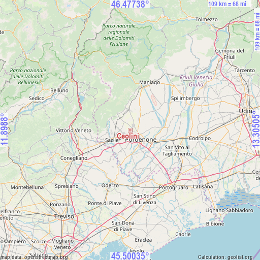
Ceolini GPS coordinates[2]
45° 59' 27.672" North, 12° 36' 6.912" East
| Map corner | latitude | longitude |
|---|---|---|
| Upper-left | 46.47738°, | 11.8988° |
| Center: | 45.99102°, | 12.60192° |
| Lower-right: | 45.50035°, | 13.30505° |
| Map W x H: | 108.6×108.6 km | = 67.5×67.5mi |
| max Lat: | 47.04031° ⇑8.2% North |
| Ceolini: | 45.99102° |
| min Lat: | ⇓91.8% South 35.50142° |
| min Long | Ceolini | max Long |
| 6.69888° | 12.60192° | 18.48682° |
| W 63.6%⇐ | ⇒36.4% E |
Elevation
Elevation of Ceolini is 67 m = 220 ft, and this is 239.7 m = 786 ft below average elevation for this country.
| Max E: |
2085 m = 6841 ft | 76.5% |
| Avg. | 306.7 m = 1006 ft | |
| Ceolini | 67 m = 220 ft | |
Min E: |
-4 m = -13 ft | 23.5% |
See also: Italy elevation on elevation.city.
Geographical zone
Ceolini is located in North temperate zone (between Tropic of Cancer and the Arctic Circle). Distance of this North polar circle is 2287.5 km =1421.4 mi to North.| Distance of | km | miles | from Ceolini |
|---|---|---|---|
| North Pole | 4893.3 | 3040.6 | to North |
| Arctic Circle | 2287.5 | 1421.4 | to North |
| Tropic Cancer | 2507.8 | 1558.3 | to South |
| Equator | 5113.7 | 3177.5 | to South |


Nearby cities:
15 places around Ceolini: (largest is in red/bold)
• Aviano-Castello
8.6 km =5.3 mi,  350°
350°
• Budoia
7.9 km =4.9 mi,  318°
318°
• Cordenons
7.7 km =4.8 mi,  96°
96°
• Musil
7.7 km =4.8 mi,  109°
109°
• Nave
7.8 km =4.8 mi,  260°
260°
• Palse
4.9 km =3 mi,  176°
176°
• Porcia
3.3 km =2.1 mi,  160°
160°
• Pordenone
5.9 km =3.7 mi,  129°
129°
• Roveredo in Piano
2.4 km =1.5 mi,  34°
34°
• San Giovanni
7.5 km =4.7 mi,  296°
296°
• San Quirino
7.6 km =4.7 mi,  50°
50°
• Sedrano
8.4 km =5.2 mi,  35°
35°
• Tamai
7.8 km =4.8 mi,  197°
197°
• Vigonovo-Fontanafredda
4.2 km =2.6 mi,  267°
267°
• Villa D'Arco
5 km =3.1 mi,  79°
79°
Sources, notices
• [Note1] Compared only with cities in Italy existing in our database
• [Src1] Map data: © OpenStreetMap contributors (CC-BY-SA)
• [Src2] Other city data from geonames.org with taken over terms of usage.
• [Src3] Geographical zone / Annual Mean Temperature by Robert A. Rohde @ Wikipedia
