Nave geodata
Nave (Friuli Venezia Giulia) is a populated locality; located in Italy in Europe/Rome (GMT+2) time zone. With population of 818 people, there are 7553 cities with bigger population in this country. Compared to other cities in Italy, 91.4% of cities are located further ↓South; 62.4% of cities are located further ←West and 86.4% of cities have higher elevation than Nave. Note1
Administrative division(s):
- Level 1: Friuli Venezia Giulia
- Level 2: Provincia di Pordenone
- Level 3: Fontanafredda


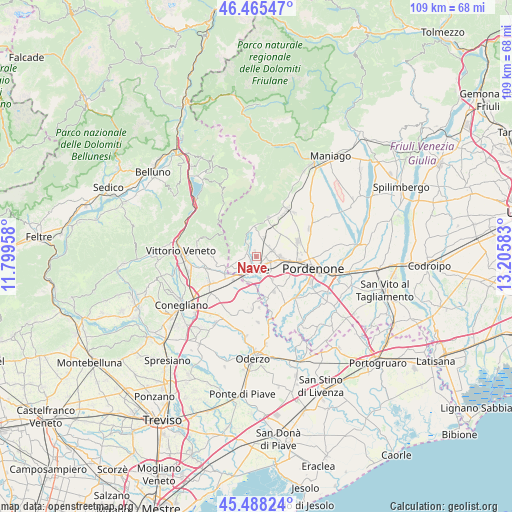
Nave GPS coordinates[2]
45° 58' 44.436" North, 12° 30' 9.72" East
| Map corner | latitude | longitude |
|---|---|---|
| Upper-left | 46.46547°, | 11.79958° |
| Center: | 45.97901°, | 12.5027° |
| Lower-right: | 45.48824°, | 13.20583° |
| Map W x H: | 108.7×108.7 km | = 67.5×67.5mi |
| max Lat: | 47.04031° ⇑8.6% North |
| Nave: | 45.97901° |
| min Lat: | ⇓91.4% South 35.50142° |
| min Long | Nave | max Long |
| 6.69888° | 12.5027° | 18.48682° |
| W 62.4%⇐ | ⇒37.6% E |
Elevation
Elevation of Nave is 27 m = 89 ft, and this is 279.7 m = 918 ft below average elevation for this country.
| Max E: |
2085 m = 6841 ft | 86.4% |
| Avg. | 306.7 m = 1006 ft | |
| Nave | 27 m = 89 ft | |
Min E: |
-4 m = -13 ft | 13.6% |
See also: Italy elevation on elevation.city.
Geographical zone
Nave is located in North temperate zone (between Tropic of Cancer and the Arctic Circle). Distance of this North polar circle is 2288.8 km =1422.2 mi to North.| Distance of | km | miles | from Nave |
|---|---|---|---|
| North Pole | 4894.7 | 3041.4 | to North |
| Arctic Circle | 2288.8 | 1422.2 | to North |
| Tropic Cancer | 2506.5 | 1557.5 | to South |
| Equator | 5112.4 | 3176.7 | to South |


Nearby cities:
15 places around Nave: (largest is in red/bold)
• Budoia
7.7 km =4.8 mi,  18°
18°
• Caneva
4 km =2.5 mi,  256°
256°
• Cavolano-Schiavoi
5.1 km =3.2 mi,  182°
182°
• Ceolini
7.8 km =4.8 mi,  80°
80°
• Cordignano
7.5 km =4.7 mi,  243°
243°
• Francenigo
7.9 km =4.9 mi, 179°
• Orsago
8 km =5 mi,  226°
226°
• Palse
8.8 km =5.5 mi,  114°
114°
• Polcenigo
6.6 km =4.1 mi,  0°
0°
• Sacile
2.8 km =1.7 mi, 179°
• San Giovanni
4.8 km =3 mi,  11°
11°
• San Giovanni di Livenza
6.6 km =4.1 mi,  171°
171°
• Tamai
8.1 km =5 mi,  138°
138°
• Vigonovo-Fontanafredda
3.6 km =2.2 mi,  71°
71°
• Villa di Villa
6.9 km =4.3 mi, 258°
Sources, notices
• [Note1] Compared only with cities in Italy existing in our database
• [Src1] Map data: © OpenStreetMap contributors (CC-BY-SA)
• [Src2] Other city data from geonames.org with taken over terms of usage.
• [Src3] Geographical zone / Annual Mean Temperature by Robert A. Rohde @ Wikipedia
