Roccatederighi geodata
Roccatederighi (Tuscany) is a populated place; located in Italy in Europe/Rome (GMT+2) time zone. With population of 773 people, there are 7801 cities with bigger population in this country. Compared to other cities in Italy, 63.2% of cities are located further ↑North; 56.2% of cities are located further →East and 79.5% of cities have lower elevation than Roccatederighi. Note1


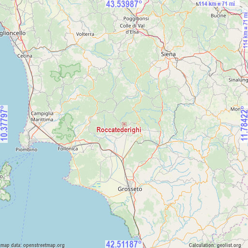
Roccatederighi GPS coordinates[2]
43° 1' 40.872" North, 11° 4' 51.924" East
| Map corner | latitude | longitude |
|---|---|---|
| Upper-left | 43.53987°, | 10.37797° |
| Center: | 43.02802°, | 11.08109° |
| Lower-right: | 42.51187°, | 11.78422° |
| Map W x H: | 114.3×114.3 km | = 71×71mi |
| max Lat: | 47.04031° ⇑63.2% North |
| Roccatederighi: | 43.02802° |
| min Lat: | ⇓36.8% South 35.50142° |
| min Long | Roccatederighi | max Long |
| 6.69888° | 11.08109° | 18.48682° |
| W 43.8%⇐ | ⇒56.2% E |
Elevation
Elevation of Roccatederighi is 519 m = 1703 ft, and this is 212.3 m = 697 ft above average elevation for this country.
| Max E: |
2085 m = 6841 ft | 20.5% |
| Roccatederighi | 519 m 1703 ft | |
| Avg. | 306.7 m = 1006 ft | |
Min E: |
-4 m = -13 ft | 79.5% |
See also: Italy elevation on elevation.city.
Geographical zone
Roccatederighi is located in North temperate zone (between Tropic of Cancer and the Arctic Circle). Distance of this Northern Tropic circle is 2178.3 km =1353.5 mi to South.| Distance of | km | miles | from Roccatederighi |
|---|---|---|---|
| North Pole | 5222.8 | 3245.3 | to North |
| Arctic Circle | 2616.9 | 1626.1 | to North |
| Tropic Cancer | 2178.3 | 1353.5 | to South |
| Equator | 4784.3 | 2972.8 | to South |


Nearby cities:
15 places around Roccatederighi: (largest is in red/bold)
• Batignano
19.2 km =11.9 mi,  158°
158°
• Braccagni
17.3 km =10.7 mi,  182°
182°
• Chiusdino
14.1 km =8.8 mi,  0°
0°
• Civitella Marittima
16.7 km =10.4 mi,  103°
103°
• Filare-Boschetto-Miniera
18.7 km =11.6 mi,  232°
232°
• Gavorrano
18.2 km =11.3 mi, 231°
• Massa Marittima
15.4 km =9.6 mi,  278°
278°
• Monticiano
14.7 km =9.1 mi,  32°
32°
• Montieri
12.6 km =7.8 mi,  335°
335°
• Paganico
18.5 km =11.5 mi,  123°
123°
• Prata
9.9 km =6.2 mi,  308°
308°
• Ribolla
7.4 km =4.6 mi,  210°
210°
• Roccastrada
7.3 km =4.5 mi,  106°
106°
• Sassofortino
2.5 km =1.6 mi, 95°
• Sticciano Scalo
11.8 km =7.3 mi,  165°
165°
Sources, notices
• [Note1] Compared only with cities in Italy existing in our database
• [Src1] Map data: © OpenStreetMap contributors (CC-BY-SA)
• [Src2] Other city data from geonames.org with taken over terms of usage.
• [Src3] Geographical zone / Annual Mean Temperature by Robert A. Rohde @ Wikipedia
