Castell'Azzara geodata
Castell'Azzara (Tuscany) is a seat of a third-order administrative division; located in Italy in Europe/Rome (GMT+2) time zone. With population of 980 people, there are 6738 cities with bigger population in this country. Compared to other cities in Italy, 64.8% of cities are located further ↑North; 51.8% of cities are located further ←West and 93% of cities have lower elevation than Castell'Azzara. Note1


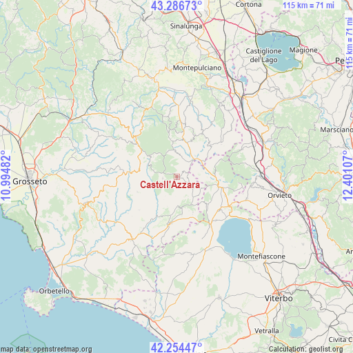
Castell'Azzara GPS coordinates[2]
42° 46' 21.9" North, 11° 41' 52.584" East
| Map corner | latitude | longitude |
|---|---|---|
| Upper-left | 43.28673°, | 10.99482° |
| Center: | 42.77275°, | 11.69794° |
| Lower-right: | 42.25447°, | 12.40107° |
| Map W x H: | 114.8×114.8 km | = 71.3×71.3mi |
| max Lat: | 47.04031° ⇑64.8% North |
| Castell'Azzara: | 42.77275° |
| min Lat: | ⇓35.2% South 35.50142° |
| min Long | Castell'Azzara | max Long |
| 6.69888° | 11.69794° | 18.48682° |
| W 51.8%⇐ | ⇒48.2% E |
Elevation
Elevation of Castell'Azzara is 801 m = 2628 ft, and this is 494.3 m = 1622 ft above average elevation for this country.
| Max E: |
2085 m = 6841 ft | 7% |
| Castell'Azzara | 801 m 2628 ft | |
| Avg. | 306.7 m = 1006 ft | |
Min E: |
-4 m = -13 ft | 93% |
See also: Italy elevation on elevation.city.
Geographical zone
Castell'Azzara is located in North temperate zone (between Tropic of Cancer and the Arctic Circle). Distance of this Northern Tropic circle is 2150 km =1335.9 mi to South.| Distance of | km | miles | from Castell'Azzara |
|---|---|---|---|
| North Pole | 5251.2 | 3262.9 | to North |
| Arctic Circle | 2645.3 | 1643.7 | to North |
| Tropic Cancer | 2150 | 1335.9 | to South |
| Equator | 4755.9 | 2955.2 | to South |


Nearby cities:
15 places around Castell'Azzara: (largest is in red/bold)
• Abbadia San Salvatore
12.2 km =7.6 mi,  350°
350°
• Acquapendente
14.3 km =8.9 mi,  103°
103°
• Arcidosso
17.2 km =10.7 mi,  309°
309°
• Bagnolo
10 km =6.2 mi,  319°
319°
• Grotte di Castro
17.7 km =11 mi,  127°
127°
• Onano
13.2 km =8.2 mi, 133°
• Piancastagnaio
8.7 km =5.4 mi,  355°
355°
• Pitigliano
15.3 km =9.5 mi,  187°
187°
• Proceno
10.8 km =6.7 mi, 99°
• Radicofani
14.9 km =9.3 mi,  22°
22°
• Roccalbegna
15.6 km =9.7 mi,  275°
275°
• San Casciano dei Bagni
18.1 km =11.2 mi,  53°
53°
• Santa Fiora
11.3 km =7 mi, 305°
• Semproniano
13.7 km =8.5 mi,  249°
249°
• Sorano
10.3 km =6.4 mi,  170°
170°
Sources, notices
• [Note1] Compared only with cities in Italy existing in our database
• [Src1] Map data: © OpenStreetMap contributors (CC-BY-SA)
• [Src2] Other city data from geonames.org with taken over terms of usage.
• [Src3] Geographical zone / Annual Mean Temperature by Robert A. Rohde @ Wikipedia
