Provesano geodata
Provesano (Friuli Venezia Giulia) is a populated place; located in Italy in Europe/Rome (GMT+2) time zone. With population of 523 people, there are 9703 cities with bigger population in this country. Compared to other cities in Italy, 93.4% of cities are located further ↓South; 67.1% of cities are located further ←West and 71.3% of cities have higher elevation than Provesano. Note1
Administrative division(s):
- Level 1: Friuli Venezia Giulia
- Level 2: Provincia di Pordenone
- Level 3: San Giorgio della Richinvelda


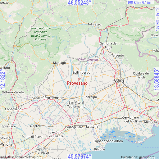
Provesano GPS coordinates[2]
46° 4' 0.264" North, 12° 53' 7.152" East
| Map corner | latitude | longitude |
|---|---|---|
| Upper-left | 46.55243°, | 12.1822° |
| Center: | 46.06674°, | 12.88532° |
| Lower-right: | 45.57674°, | 13.58845° |
| Map W x H: | 108.5×108.5 km | = 67.4×67.4mi |
| max Lat: | 47.04031° ⇑6.6% North |
| Provesano: | 46.06674° |
| min Lat: | ⇓93.4% South 35.50142° |
| min Long | Provesano | max Long |
| 6.69888° | 12.88532° | 18.48682° |
| W 67.1%⇐ | ⇒32.9% E |
Elevation
Elevation of Provesano is 91 m = 299 ft, and this is 215.7 m = 708 ft below average elevation for this country.
| Max E: |
2085 m = 6841 ft | 71.3% |
| Avg. | 306.7 m = 1006 ft | |
| Provesano | 91 m = 299 ft | |
Min E: |
-4 m = -13 ft | 28.7% |
See also: Italy elevation on elevation.city.
Geographical zone
Provesano is located in North temperate zone (between Tropic of Cancer and the Arctic Circle). Distance of this North polar circle is 2279 km =1416.1 mi to North.| Distance of | km | miles | from Provesano |
|---|---|---|---|
| North Pole | 4884.9 | 3035.3 | to North |
| Arctic Circle | 2279 | 1416.1 | to North |
| Tropic Cancer | 2516.2 | 1563.5 | to South |
| Equator | 5122.1 | 3182.7 | to South |


Nearby cities:
15 places around Provesano: (largest is in red/bold)
• Arzene
7.9 km =4.9 mi,  199°
199°
• Barbeano
2.6 km =1.6 mi,  330°
330°
• Carpacco
8.1 km =5 mi,  44°
44°
• Cisterna
8.2 km =5.1 mi,  75°
75°
• Dignano
4.6 km =2.9 mi,  65°
65°
• Flaibano
7.7 km =4.8 mi,  96°
96°
• Gradisca
9.4 km =5.8 mi,  140°
140°
• Rauscedo-Domanins
5.5 km =3.4 mi,  238°
238°
• San Giorgio della Richinvelda
2.5 km =1.6 mi,  211°
211°
• San Martino al Tagliamento
5.7 km =3.5 mi,  192°
192°
• Sedegliano
9.2 km =5.7 mi,  129°
129°
• Spilimbergo
5.2 km =3.2 mi,  6°
6°
• Valvasone
8.3 km =5.2 mi, 190°
• Villanova
9.8 km =6.1 mi, 42°
• Vivaro
8.3 km =5.2 mi,  277°
277°
Sources, notices
• [Note1] Compared only with cities in Italy existing in our database
• [Src1] Map data: © OpenStreetMap contributors (CC-BY-SA)
• [Src2] Other city data from geonames.org with taken over terms of usage.
• [Src3] Geographical zone / Annual Mean Temperature by Robert A. Rohde @ Wikipedia
