Predoi geodata
Predoi (Trentino-Alto Adige) is a seat of a third-order administrative division; located in Italy in Europe/Rome (GMT+1) time zone. With population of 337 people, there are 10523 cities with bigger population in this country. Compared to other cities in Italy, 100% of cities are located further ↓South; 57.4% of cities are located further ←West and 99.6% of cities have lower elevation than Predoi. Note1


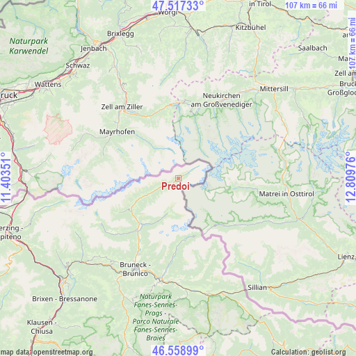
Predoi GPS coordinates[2]
47° 2' 25.116" North, 12° 6' 23.868" East
| Map corner | latitude | longitude |
|---|---|---|
| Upper-left | 47.51733°, | 11.40351° |
| Center: | 47.04031°, | 12.10663° |
| Lower-right: | 46.55899°, | 12.80976° |
| Map W x H: | 106.6×106.6 km | = 66.2×66.2mi |
| max Lat: | 47.04031° ⇑0% North |
| Predoi: | 47.04031° |
| min Lat: | ⇓100% South 35.50142° |
| min Long | Predoi | max Long |
| 6.69888° | 12.10663° | 18.48682° |
| W 57.4%⇐ | ⇒42.6% E |
Elevation
Elevation of Predoi is 1466 m = 4810 ft, and this is 1159.3 m = 3803 ft above average elevation for this country.
| Max E: |
2085 m = 6841 ft | 0.40000000000001% |
| Predoi | 1466 m 4810 ft | |
| Avg. | 306.7 m = 1006 ft | |
Min E: |
-4 m = -13 ft | 99.6% |
See also: Italy elevation on elevation.city.
Geographical zone
Predoi is located in North temperate zone (between Tropic of Cancer and the Arctic Circle). Distance of this North polar circle is 2170.8 km =1348.9 mi to North.| Distance of | km | miles | from Predoi |
|---|---|---|---|
| North Pole | 4776.7 | 2968.1 | to North |
| Arctic Circle | 2170.8 | 1348.9 | to North |
| Tropic Cancer | 2624.5 | 1630.8 | to South |
| Equator | 5230.4 | 3250 | to South |


Nearby cities:
15 places around Predoi: (largest is in red/bold)
• Anterselva di Mezzo
20.2 km =12.6 mi,  181°
181°
• Cadipietra
10.8 km =6.7 mi,  242°
242°
• Campo Tures
18.4 km =11.4 mi,  217°
217°
• Gais
25.6 km =15.9 mi,  207°
207°
• Lutago
17.5 km =10.9 mi,  234°
234°
• Mühlen in Taufers
20 km =12.4 mi, 218°
• Perca
29 km =18 mi,  198°
198°
• Rasun Anterselva - Rasen-Antholz
29.5 km =18.3 mi,  188°
188°
• Rasun di Sopra
28.1 km =17.5 mi, 187°
• San Giovanni
14.2 km =8.8 mi, 241°
• San Martino
27.1 km =16.8 mi,  160°
160°
• Selva dei Molini
25.2 km =15.7 mi, 228°
• Teodone
28.8 km =17.9 mi, 203°
• Uttenheim
22.9 km =14.2 mi, 211°
• Valle Aurina - Ahrntal
10.8 km =6.7 mi, 242°
Sources, notices
• [Note1] Compared only with cities in Italy existing in our database
• [Src1] Map data: © OpenStreetMap contributors (CC-BY-SA)
• [Src2] Other city data from geonames.org with taken over terms of usage.
• [Src3] Geographical zone / Annual Mean Temperature by Robert A. Rohde @ Wikipedia
