Valle Aurina - Ahrntal geodata
Valle Aurina - Ahrntal (Trentino-Alto Adige) is a seat of a third-order administrative division; located in Italy in Europe/Rome (GMT+1) time zone. With population of 5,517 people, there are 1780 cities with bigger population in this country. Compared to other cities in Italy, 100% of cities are located further ↓South; 55.6% of cities are located further ←West and 97.7% of cities have lower elevation than Valle Aurina - Ahrntal. Note1


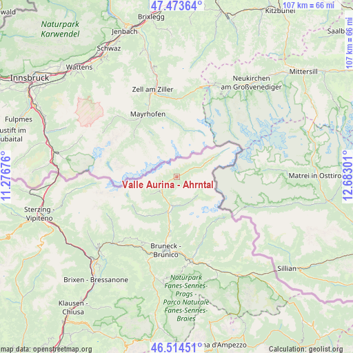
Valle Aurina - Ahrntal GPS coordinates[2]
46° 59' 46.428" North, 11° 58' 47.568" East
| Map corner | latitude | longitude |
|---|---|---|
| Upper-left | 47.47364°, | 11.27676° |
| Center: | 46.99623°, | 11.97988° |
| Lower-right: | 46.51451°, | 12.68301° |
| Map W x H: | 106.6×106.6 km | = 66.2×66.2mi |
| max Lat: | 47.04031° ⇑0% North |
| Valle Aurina - Ahrntal: | 46.99623° |
| min Lat: | ⇓100% South 35.50142° |
| min Long | Valle Aurina - | max Long |
| 6.69888° | 11.97988° | 18.48682° |
| W 55.6%⇐ | ⇒44.4% E |
Elevation
Elevation of Valle Aurina - Ahrntal is 1062 m = 3484 ft, and this is 755.3 m = 2478 ft above average elevation for this country.
| Max E: |
2085 m = 6841 ft | 2.3% |
| Valle Aurina - Ahrntal | 1062 m 3484 ft | |
| Avg. | 306.7 m = 1006 ft | |
Min E: |
-4 m = -13 ft | 97.7% |
See also: Italy elevation on elevation.city.
Geographical zone
Valle Aurina - Ahrntal is located in North temperate zone (between Tropic of Cancer and the Arctic Circle). Distance of this North polar circle is 2175.7 km =1351.9 mi to North.| Distance of | km | miles | from Valle Aurina - Ahrntal |
|---|---|---|---|
| North Pole | 4781.6 | 2971.1 | to North |
| Arctic Circle | 2175.7 | 1351.9 | to North |
| Tropic Cancer | 2619.6 | 1627.7 | to South |
| Equator | 5225.5 | 3247 | to South |


Nearby cities:
15 places around Valle Aurina - Ahrntal: (largest is in red/bold)
• Anterselva di Mezzo
17.8 km =11.1 mi,  149°
149°
• Brunico
22.2 km =13.8 mi,  188°
188°
• Cadipietra
0.1 km =0.1 mi, 151°
• Campo Tures
9.9 km =6.2 mi, 188°
• Chienes
23.6 km =14.7 mi,  206°
206°
• Falzes
21.6 km =13.4 mi,  199°
199°
• Gais
17.9 km =11.1 mi, 187°
• Lutago
7 km =4.3 mi,  221°
221°
• Mühlen in Taufers
11.1 km =6.9 mi, 194°
• Perca
22.6 km =14 mi,  179°
179°
• Predoi
10.8 km =6.7 mi,  62°
62°
• San Giovanni
3.4 km =2.1 mi,  238°
238°
• Selva dei Molini
15 km =9.3 mi, 218°
• Teodone
21.5 km =13.4 mi, 185°
• Uttenheim
14.8 km =9.2 mi, 189°
Sources, notices
• [Note1] Compared only with cities in Italy existing in our database
• [Src1] Map data: © OpenStreetMap contributors (CC-BY-SA)
• [Src2] Other city data from geonames.org with taken over terms of usage.
• [Src3] Geographical zone / Annual Mean Temperature by Robert A. Rohde @ Wikipedia
