Podenzana geodata
Podenzana (Tuscany) is a seat of a third-order administrative division; located in Italy in Europe/Rome (GMT+2) time zone. With population of 1,819 people, there are 4462 cities with bigger population in this country. Compared to other cities in Italy, 52.7% of cities are located further ↑North; 68.4% of cities are located further →East and 56.6% of cities have lower elevation than Podenzana. Note1


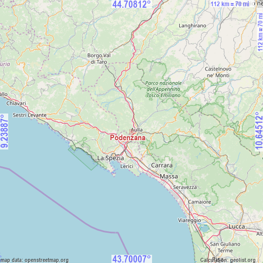
Podenzana GPS coordinates[2]
44° 12' 22.5" North, 9° 56' 31.164" East
| Map corner | latitude | longitude |
|---|---|---|
| Upper-left | 44.70812°, | 9.23887° |
| Center: | 44.20625°, | 9.94199° |
| Lower-right: | 43.70007°, | 10.64512° |
| Map W x H: | 112.1×112.1 km | = 69.7×69.7mi |
| max Lat: | 47.04031° ⇑52.7% North |
| Podenzana: | 44.20625° |
| min Lat: | ⇓47.3% South 35.50142° |
| min Long | Podenzana | max Long |
| 6.69888° | 9.94199° | 18.48682° |
| W 31.6%⇐ | ⇒68.4% E |
Elevation
Elevation of Podenzana is 276 m = 906 ft, and this is 30.7 m = 101 ft below average elevation for this country.
| Max E: |
2085 m = 6841 ft | 43.4% |
| Avg. | 306.7 m = 1006 ft | |
| Podenzana | 276 m = 906 ft | |
Min E: |
-4 m = -13 ft | 56.6% |
See also: Italy elevation on elevation.city.
Geographical zone
Podenzana is located in North temperate zone (between Tropic of Cancer and the Arctic Circle). Distance of this Northern Tropic circle is 2309.4 km =1435 mi to South.| Distance of | km | miles | from Podenzana |
|---|---|---|---|
| North Pole | 5091.8 | 3163.9 | to North |
| Arctic Circle | 2485.9 | 1544.7 | to North |
| Tropic Cancer | 2309.4 | 1435 | to South |
| Equator | 4915.3 | 3054.2 | to South |


Nearby cities:
15 places around Podenzana: (largest is in red/bold)
• Albiano Magra
4 km =2.5 mi,  211°
211°
• Aulla
2.9 km =1.8 mi,  89°
89°
• Barbarasco
3.9 km =2.4 mi,  4°
4°
• Bolano
4.3 km =2.7 mi,  241°
241°
• Ceparana-Carpena
6.4 km =4 mi,  226°
226°
• Masero
3.2 km =2 mi,  43°
43°
• Montale
0.2 km =0.1 mi, 91°
• Monti
7.1 km =4.4 mi,  48°
48°
• Pallerone
4.8 km =3 mi, 91°
• Piana Battolla
7.2 km =4.5 mi,  258°
258°
• Piano di Follo
7.9 km =4.9 mi, 233°
• Piano di Valeriano-Bottagna
8.2 km =5.1 mi,  221°
221°
• Santo Stefano di Magra
6.6 km =4.1 mi,  194°
194°
• Terrarossa
3.4 km =2.1 mi,  26°
26°
• Tresana
5.8 km =3.6 mi,  336°
336°
Sources, notices
• [Note1] Compared only with cities in Italy existing in our database
• [Src1] Map data: © OpenStreetMap contributors (CC-BY-SA)
• [Src2] Other city data from geonames.org with taken over terms of usage.
• [Src3] Geographical zone / Annual Mean Temperature by Robert A. Rohde @ Wikipedia
