Paduli geodata
Paduli (Campania) is a seat of a third-order administrative division; located in Italy in Europe/Rome (GMT+2) time zone. With population of 1,870 people, there are 4370 cities with bigger population in this country. Compared to other cities in Italy, 77.1% of cities are located further ↑North; 86.3% of cities are located further ←West and 67.2% of cities have lower elevation than Paduli. Note1


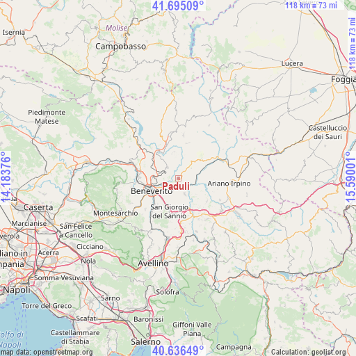
Paduli GPS coordinates[2]
41° 10' 4.548" North, 14° 53' 12.768" East
| Map corner | latitude | longitude |
|---|---|---|
| Upper-left | 41.69509°, | 14.18376° |
| Center: | 41.16793°, | 14.88688° |
| Lower-right: | 40.63649°, | 15.59001° |
| Map W x H: | 117.7×117.7 km | = 73.1×73.1mi |
| max Lat: | 47.04031° ⇑77.1% North |
| Paduli: | 41.16793° |
| min Lat: | ⇓22.9% South 35.50142° |
| min Long | Paduli | max Long |
| 6.69888° | 14.88688° | 18.48682° |
| W 86.3%⇐ | ⇒13.7% E |
Elevation
Elevation of Paduli is 365 m = 1198 ft, and this is 58.3 m = 191 ft above average elevation for this country.
| Max E: |
2085 m = 6841 ft | 32.8% |
| Paduli | 365 m 1198 ft | |
| Avg. | 306.7 m = 1006 ft | |
Min E: |
-4 m = -13 ft | 67.2% |
See also: Italy elevation on elevation.city.
Geographical zone
Paduli is located in North temperate zone (between Tropic of Cancer and the Arctic Circle). Distance of this Northern Tropic circle is 1971.5 km =1225 mi to South.| Distance of | km | miles | from Paduli |
|---|---|---|---|
| North Pole | 5429.6 | 3373.8 | to North |
| Arctic Circle | 2823.7 | 1754.6 | to North |
| Tropic Cancer | 1971.5 | 1225 | to South |
| Equator | 4577.4 | 2844.3 | to South |


Nearby cities:
15 places around Paduli: (largest is in red/bold)
• Apice Vecchio
6.5 km =4 mi,  145°
145°
• Benevento
10 km =6.2 mi,  245°
245°
• Buonalbergo
9.7 km =6 mi,  51°
51°
• Calvi
10.9 km =6.8 mi,  189°
189°
• Cesine
9.5 km =5.9 mi, 192°
• Iannassi-Bosco Perrotta
9.6 km =6 mi,  207°
207°
• Maccoli-Perrillo
11.2 km =7 mi,  217°
217°
• Pago Veiano
8.5 km =5.3 mi,  347°
347°
• Pastene
11.3 km =7 mi, 212°
• Pesco Sannita
9.6 km =6 mi,  318°
318°
• Pietrelcina
5 km =3.1 mi,  314°
314°
• San Giorgio del Sannio
11.4 km =7.1 mi, 194°
• San Nicola Manfredi
11.6 km =7.2 mi, 206°
• Sant'Arcangelo Trimonte
4.3 km =2.7 mi,  88°
88°
• Santa Colomba II
11.1 km =6.9 mi,  233°
233°
Sources, notices
• [Note1] Compared only with cities in Italy existing in our database
• [Src1] Map data: © OpenStreetMap contributors (CC-BY-SA)
• [Src2] Other city data from geonames.org with taken over terms of usage.
• [Src3] Geographical zone / Annual Mean Temperature by Robert A. Rohde @ Wikipedia
