Fiorano geodata
Fiorano (Emilia-Romagna) is a seat of a third-order administrative division; located in Italy in Europe/Rome (GMT+2) time zone. With population of 16,278 people, there are 558 cities with bigger population in this country. Compared to other cities in Italy, 51.5% of cities are located further ↓South; 59.6% of cities are located further →East and 65.5% of cities have higher elevation than Fiorano. Note1
Administrative division(s):
- Level 1: Emilia-Romagna
- Level 2: Provincia di Modena
- Level 3: Fiorano Modenese


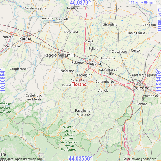
Fiorano GPS coordinates[2]
44° 32' 20.004" North, 10° 48' 41.976" East
| Map corner | latitude | longitude |
|---|---|---|
| Upper-left | 45.0379°, | 10.10854° |
| Center: | 44.53889°, | 10.81166° |
| Lower-right: | 44.03556°, | 11.51479° |
| Map W x H: | 111.4×111.4 km | = 69.2×69.2mi |
| max Lat: | 47.04031° ⇑48.5% North |
| Fiorano: | 44.53889° |
| min Lat: | ⇓51.5% South 35.50142° |
| min Long | Fiorano | max Long |
| 6.69888° | 10.81166° | 18.48682° |
| W 40.4%⇐ | ⇒59.6% E |
Elevation
Elevation of Fiorano is 125 m = 410 ft, and this is 181.7 m = 596 ft below average elevation for this country.
| Max E: |
2085 m = 6841 ft | 65.5% |
| Avg. | 306.7 m = 1006 ft | |
| Fiorano | 125 m = 410 ft | |
Min E: |
-4 m = -13 ft | 34.5% |
See also: Italy elevation on elevation.city.
Geographical zone
Fiorano is located in North temperate zone (between Tropic of Cancer and the Arctic Circle). Distance of this Northern Tropic circle is 2346.3 km =1457.9 mi to South.| Distance of | km | miles | from Fiorano |
|---|---|---|---|
| North Pole | 5054.8 | 3140.9 | to North |
| Arctic Circle | 2448.9 | 1521.7 | to North |
| Tropic Cancer | 2346.3 | 1457.9 | to South |
| Equator | 4952.3 | 3077.2 | to South |


Nearby cities:
15 places around Fiorano: (largest is in red/bold)
• Cadiroggio
5.6 km =3.5 mi,  281°
281°
• Casalgrande
7.9 km =4.9 mi,  310°
310°
• Castellarano
6.3 km =3.9 mi,  248°
248°
• Colombaro
6.9 km =4.3 mi,  78°
78°
• Formigine
4.7 km =2.9 mi,  36°
36°
• Gorzano
6 km =3.7 mi,  114°
114°
• Magreta
6.9 km =4.3 mi,  352°
352°
• Maranello
4.6 km =2.9 mi,  100°
100°
• Pozza
6.5 km =4 mi, 102°
• Salvaterra
7.5 km =4.7 mi,  333°
333°
• San Michele dei Mucchietti
6.1 km =3.8 mi,  236°
236°
• San Venanzio
5.7 km =3.5 mi,  140°
140°
• Sassuolo
2.2 km =1.4 mi, 282°
• Torre Maina
6.6 km =4.1 mi,  132°
132°
• Veggia-Villalunga
5 km =3.1 mi,  298°
298°
In other languages:
- In Spanish: Fiorano Modenese
- In France: Fiorano Modenese
- In Italian: Fiorano Modenese
Sources, notices
• [Note1] Compared only with cities in Italy existing in our database
• [Src1] Map data: © OpenStreetMap contributors (CC-BY-SA)
• [Src2] Other city data from geonames.org with taken over terms of usage.
• [Src3] Geographical zone / Annual Mean Temperature by Robert A. Rohde @ Wikipedia
