Monte Roberto geodata
Monte Roberto (The Marches) is a seat of a third-order administrative division; located in Italy in Europe/Rome (GMT+2) time zone. With population of 256 people, there are 10866 cities with bigger population in this country. Compared to other cities in Italy, 60% of cities are located further ↑North; 69.8% of cities are located further ←West and 63.8% of cities have lower elevation than Monte Roberto. Note1
Administrative division(s):
- Level 1: The Marches
- Level 2: Provincia di Ancona
- Level 3: Monte Roberto


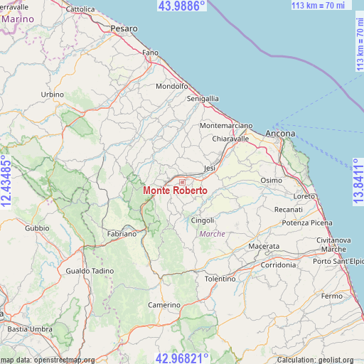
Monte Roberto GPS coordinates[2]
43° 28' 50.016" North, 13° 8' 16.692" East
| Map corner | latitude | longitude |
|---|---|---|
| Upper-left | 43.9886°, | 12.43485° |
| Center: | 43.48056°, | 13.13797° |
| Lower-right: | 42.96821°, | 13.8411° |
| Map W x H: | 113.5×113.5 km | = 70.5×70.5mi |
| max Lat: | 47.04031° ⇑60% North |
| Monte Roberto: | 43.48056° |
| min Lat: | ⇓40% South 35.50142° |
| min Long | Monte Roberto | max Long |
| 6.69888° | 13.13797° | 18.48682° |
| W 69.8%⇐ | ⇒30.2% E |
Elevation
Elevation of Monte Roberto is 332 m = 1089 ft, and this is 25.3 m = 83 ft above average elevation for this country.
| Max E: |
2085 m = 6841 ft | 36.2% |
| Monte Roberto | 332 m 1089 ft | |
| Avg. | 306.7 m = 1006 ft | |
Min E: |
-4 m = -13 ft | 63.8% |
See also: Italy elevation on elevation.city.
Geographical zone
Monte Roberto is located in North temperate zone (between Tropic of Cancer and the Arctic Circle). Distance of this Northern Tropic circle is 2228.7 km =1384.8 mi to South.| Distance of | km | miles | from Monte Roberto |
|---|---|---|---|
| North Pole | 5172.5 | 3214 | to North |
| Arctic Circle | 2566.6 | 1594.8 | to North |
| Tropic Cancer | 2228.7 | 1384.8 | to South |
| Equator | 4834.6 | 3004.1 | to South |


Nearby cities:
15 places around Monte Roberto: (largest is in red/bold)
• Angeli
5.7 km =3.5 mi,  260°
260°
• Angeli Stazione
4.7 km =2.9 mi,  270°
270°
• Castelbellino
0.9 km =0.6 mi,  38°
38°
• Castelplanio
4.8 km =3 mi,  288°
288°
• Cupramontana
4 km =2.5 mi,  210°
210°
• Macine-Borgo Loreto
4.1 km =2.5 mi,  278°
278°
• Maiolati Spontini
1.5 km =0.9 mi,  252°
252°
• Moie
2.6 km =1.6 mi,  350°
350°
• Pianello
1.9 km =1.2 mi,  54°
54°
• Pianello Vallesina
2.1 km =1.3 mi,  66°
66°
• Poggio San Marcello
6.2 km =3.9 mi,  303°
303°
• Rosora
5.6 km =3.5 mi, 273°
• San Paolo di Jesi
4 km =2.5 mi,  135°
135°
• Scorcelletti
3.7 km =2.3 mi, 42°
• Stazione
2.5 km =1.6 mi,  26°
26°
Sources, notices
• [Note1] Compared only with cities in Italy existing in our database
• [Src1] Map data: © OpenStreetMap contributors (CC-BY-SA)
• [Src2] Other city data from geonames.org with taken over terms of usage.
• [Src3] Geographical zone / Annual Mean Temperature by Robert A. Rohde @ Wikipedia
